
Damaging winds across southern Australia

A strong cold front sweeping across southern Australia has prompted severe weather warnings for damaging winds in four states.
Parts of Western Australia, South Australia, Tasmania and Victoria are likely to experience damaging wind gusts during the next couple of days due to the passage of the front.
Western Australia is first in line and has been feeling the brunt of the system since Wednesday evening. As of 11am WST today, wind gusts had reached up to 102km/h at Cape Naturaliste and 91km/h at Rottnest Island. A severe weather warning, flood watch and fire weather warning were all in place for parts of WA on Thursday morning.
Wind will start to pick up in South Australia from today and is expected to peak in strength tonight and into Friday morning. The strongest winds will occur near and ahead of the front, which should reach central parts of the state during Friday morning. The blustery northerly winds ahead of the front may cause areas of raised dust in South Australia during Friday morning, most likely over parched inland parts of the state.
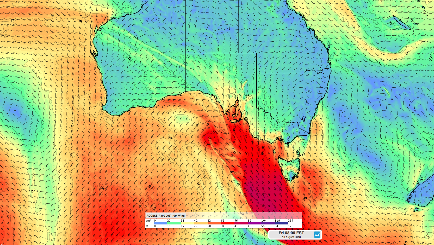
Strong north to northwesterly winds will develop in Tasmania, Victoria and southern NSW during Friday ahead of the approaching front. Damaging gusts are possible in all three states and warnings have already been issued in some areas. Alpine areas above 1500 metres in Victoria and NSW could experience destructive gusts above 125km/h and blizzards during Friday. Dry inland areas of western NSW and northern Victoria may also be affected by raised dust amid the windy conditions on Friday.
The cold front will produce a final burst of fresh to strong northwesterly winds in NSW on Saturday before moving out into the Tasman Sea on Sunday.
Like many of the cold fronts so far this season, rainfall will be mainly limited to far southern parts of the country. While some parts of South Australia and western Victoria could receive 20mm of rain by the end of Saturday, drought-affected areas of central and eastern Australia are likely to miss out once again.
In addition to the wind and rain, cold air in the wake of the front will cause small hail and highland snow in multiple states during the next couple of days. In the alps, the impending blizzard will add another layer of fresh snow to the season’s growing base, following more than half a metre of natural snow that fell during the last week.
Visit http://www.weatherzone.com.au/warnings.jsp for the latest warnings.