
Cyclonic winds slam WA
Wind gusts that you would typically see in a category two tropical cyclone have blasted southwestern Australia overnight, toppling trees and cutting power to more than 20,000 homes.
A powerful cold front linked to a deep and complex low pressure system caused squally winds across southwestern districts of Western Australia from Monday afternoon into Tuesday morning.
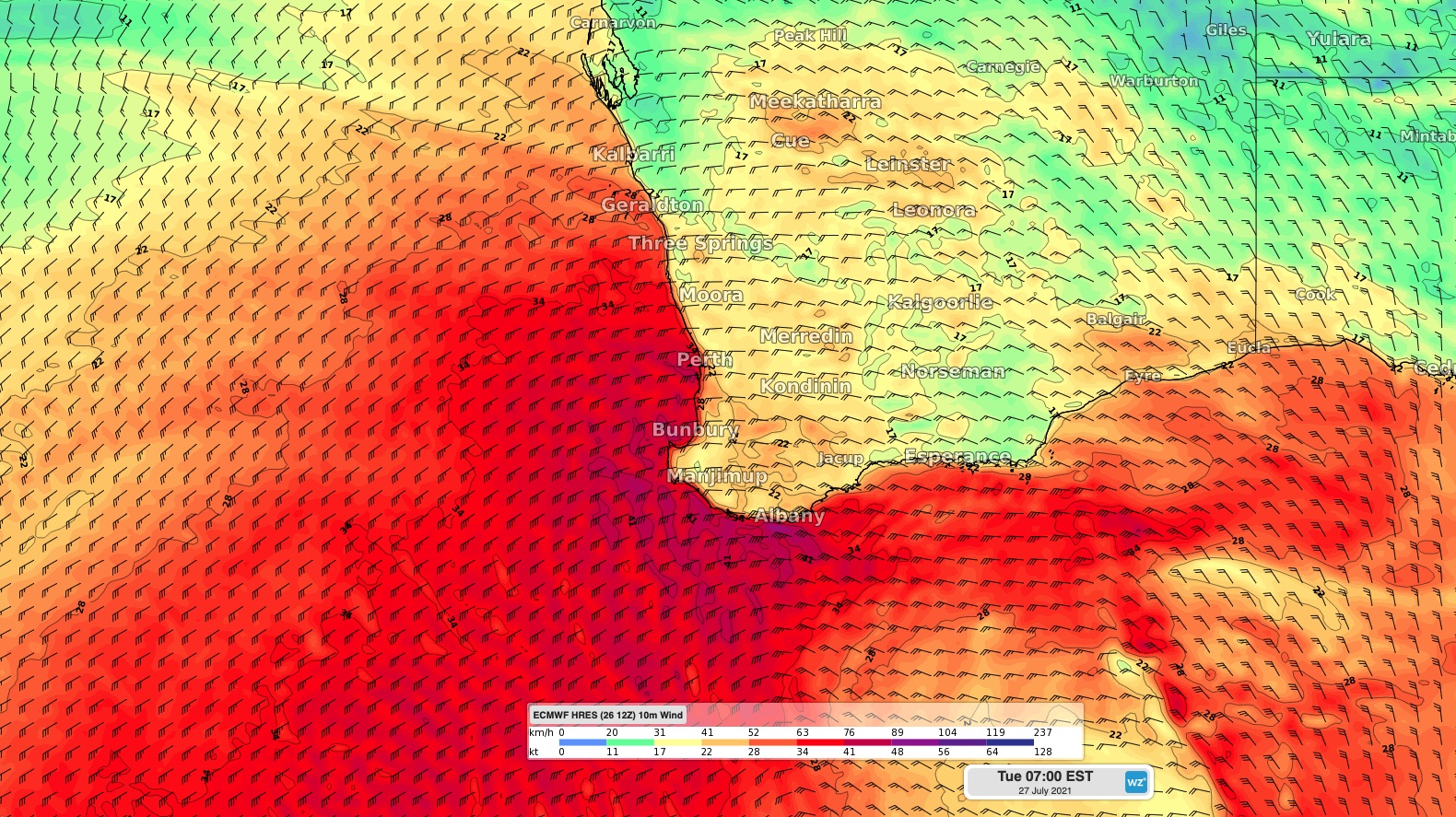
Image: Modelled wind speed and direction over southwestern Australia on Tuesday morning.
The strongest wind overnight occurred along the exposed South West Capes, where Cape Leeuwin registered a gust of 135 km/h at 2:46am. Other notable gusts included 124 km/h at Busselton Jetty and 119 km/h at Cape Naturaliste shortly before 3am, and 95km/h at Bunbury at 5am.
This was the strongest wind gust in nine years at Bunbury and eight years for Cape Leeuwin.
Closer to Perth, Rottnest Island and Mandurah both copped wind gusts of 98 km/h between 5am and 6am on Tuesday.
According to Western Power, around 21,000 homes were without power on Tuesday morning in response to the wind. These outages were spread across the Perth Metro, South West, Great Southern, Wheatbelt and Mid West regions.
UPDATE: There's currently around 21,000 homes and businesses across the network have been affected with around 13,000 located in the metro area, 3,500 in the South West and Great Southern and 4,500 in the Wheatbelt and Mid West.
— Western Power (@westernpowerwa) July 26, 2021
The blustery winds have also been accompanied by widespread rain, which extended from the state's Lower West Coast, over the Darling Range and across the Great Southern District.
Notable totals during the 22 hours to 7am on Tuesday included 85mm at Jarrahdale, 67mm at Dwellingup and 55mm at Bickley. This was Dwellingup's heaviest rain in three years.
A flood watch was in place on Tuesday morning for the Avon, Swan, Murray and Harvey River catchments.
Damaging surf and abnormally high tides could also cause beach erosion and coastal flooding on Tuesday.
Looking ahead, wind and rain will ease across the southwest of WA on Tuesday into Wednesday, although the relief will be short-lived. Another strong front will cause more damaging winds, heavy rain and thunderstorms between Thursday and Saturday.