
Cold front to impact the southeast on Monday
A cold front will cross lower parts of the southeast of Australia on Monday, bringing strong winds, cooler temperatures, showers and the odd storm.
South Australia will feel the effects of the front overnight tonight as winds strengthen ahead of the system. Gusty winds may exceed 50 km/h across the southeast from Kangaroo Island to Mt Gambier into Monday morning. Showers will also spread across the southeast of South Australia through Monday, with a few storms possible.
Gusty northerly winds will strengthen overnight into Monday across southwestern Victoria, potentially reaching over 50 km/h across the south, and Alpine areas later in the morning. Showers will also spread east across Victoria from the early hours of Monday morning. An isolated storm is also possible in the morning west of Warrnambool.
Tasmania will experience the strongest winds with the system, gaining strength from Sunday afternoon and peaking over 70 km/h on Monday morning. The strongest winds should be felt across the western and southern coasts. Widespread showers should have largely cleared by Monday evening.
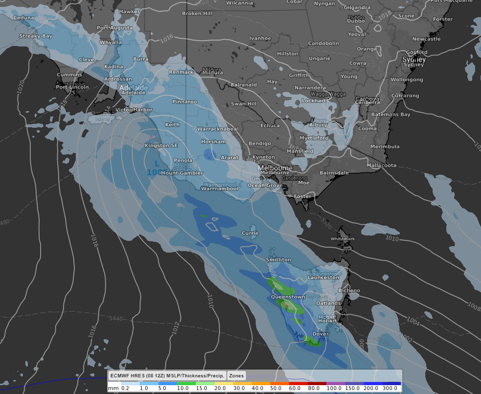 Image: Widespread showers may be expected with the passage of the front on Monday morning. ECMWF model at 10am EST Monday 10th May.
Daytime temperatures on Monday will drop a few degrees for Adelaide and Melbourne compared to Sunday, although wind chill will make the two cities feel 3 to 4 degrees cooler than actual.
Canberra and Sydney will miss the majority of this system as it remains further south as it moves into the Southern Tasman Sea.