
Cloud-band in Queens-land
A band of cloud and rain could be seen moving over Queensland on Thursday and Friday, but where did this rain fall and how much?
The cloudband is associated with a trough and decaying cold front moving from west to east and can still be seen nearing the QLD coast. The satellite images show the band thinning out as high pressure pushes in from the west, also easing the rainfall.
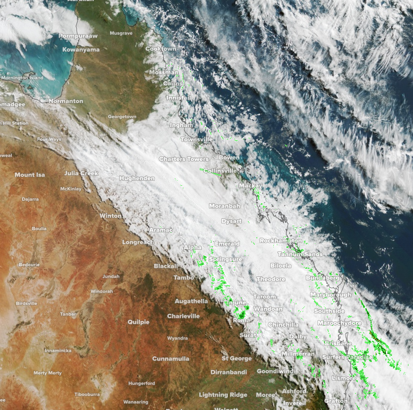
Image: Satellite imagery (Himawari-8) showing a cloudband over Queensland on Saturday morning
The unique aspect of this system was that the rainfall was spread into the western parts of the state, which typically don’t see too much rainfall at this time of year. The rainfall in 24 hours to 9am Friday was the heaviest June total in:
- 31 years at Mahrigong (54mm)
- 23 years at Cloncurry Airport (32mm)
- 14 years at Mt Isa (43mm)
- 9 years at Winton Airport (24mm)
The trough is still slowly making its way offshore and will continue to deliver rainfall along the coastal areas of Queensland during Saturday. This rainfall will not be as significant, although since 9am on Friday there has been 26 mm of rain at Miles, its wettest day in over 3 months with other locations not too far off this.
Brisbane is in for a wet and cloudy day which will result in a raw day with a forecast maximum of just 19 degrees. However, the cloud will clear up on Sunday leading to a nice and warm day to finish off the weekend.