
Clearer skies making an appearance in South Australia
After the wild weather that most of South Australia endured last week, it’s about time that the sun comes back out, even if only for a few days.
Blue skies will be a welcome sight for South Australians, as the final, weak trough begins to move east. In its wake, will be a high-pressure ridge, slowly moving across the southern states over the next few days. This high will not only bring clear skies, but also relatively calm winds, particularly on Sunday and Monday.
Of course, there is the notable downside (except for all the cold lovers out there), of freezing nights. Sunday and Monday mornings are likely to be frigid, as all the heat escapes into the atmosphere.
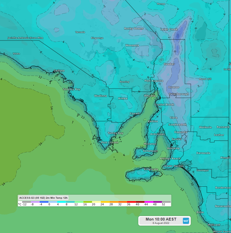
Fig 1: Forecast minimum temperatures 12 hours to 9:30am ACST
Temperatures across SA are forecast to be 3-5°C below average across the next 2 nights, with Monday likely to be the coldest of the pair for anyone living in the SE. Adelaide itself is forecast to drop to 5°C on Monday morning, 3°C below its long-term August average.
As welcome as the calm weather is, unfortunately it won’t be sticking around for long, with a trough arriving in the state on Tuesday, ahead of another low-pressure system, which will slowly make its way across the bight. This low will likely bring a return to cold, cloudy days, and gusty wet weather until at least next weekend.
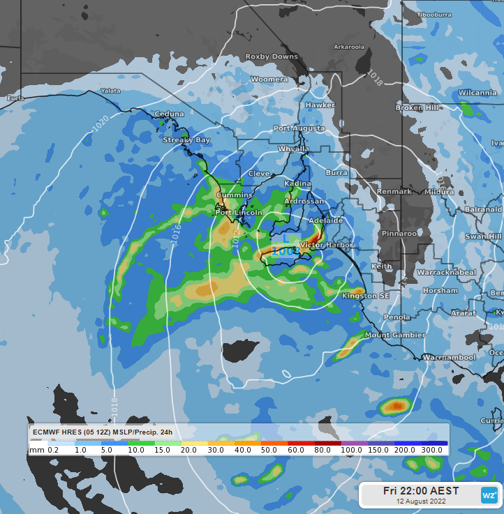
Fig 2: MSLP overly with total precipitation in 24 hrs to Friday 9:30pm ACST