
Changeable weekend weather for the east coast
For those along the east coast, you may be wondering whether the weather will make up its mind. The answer is it probably won’t, at least not today.
A system of high pressure is setting itself up in the Tasman Sea, directing easterly winds and showers over the NSW and QLD coasts, with plenty of sunny breaks in between.
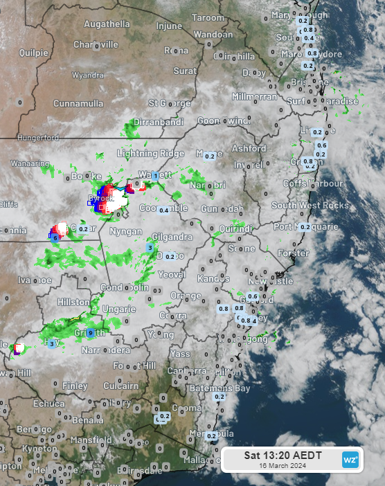
Image: Himawari satellite image of NSW and southeast Qld with observed rainfall since 9am AEDT
Numerous locations along the eastern seaboard, including suburbs of Sydney and Brisbane, have recorded some light rain today, accumulating less than 1mm so far, with patchy showers and sunny breaks likely to continue throughout the day.
Further inland, the weather is doing a better job of making up its mind, with the easterly winds feeding moisture into a weak trough over inland NSW. This is serving to trigger more substantial showers and a few thunderstorms in the state’s west, with Griffith Airport recording a more modest 8.2mm between 9am and 1pm AEDT.
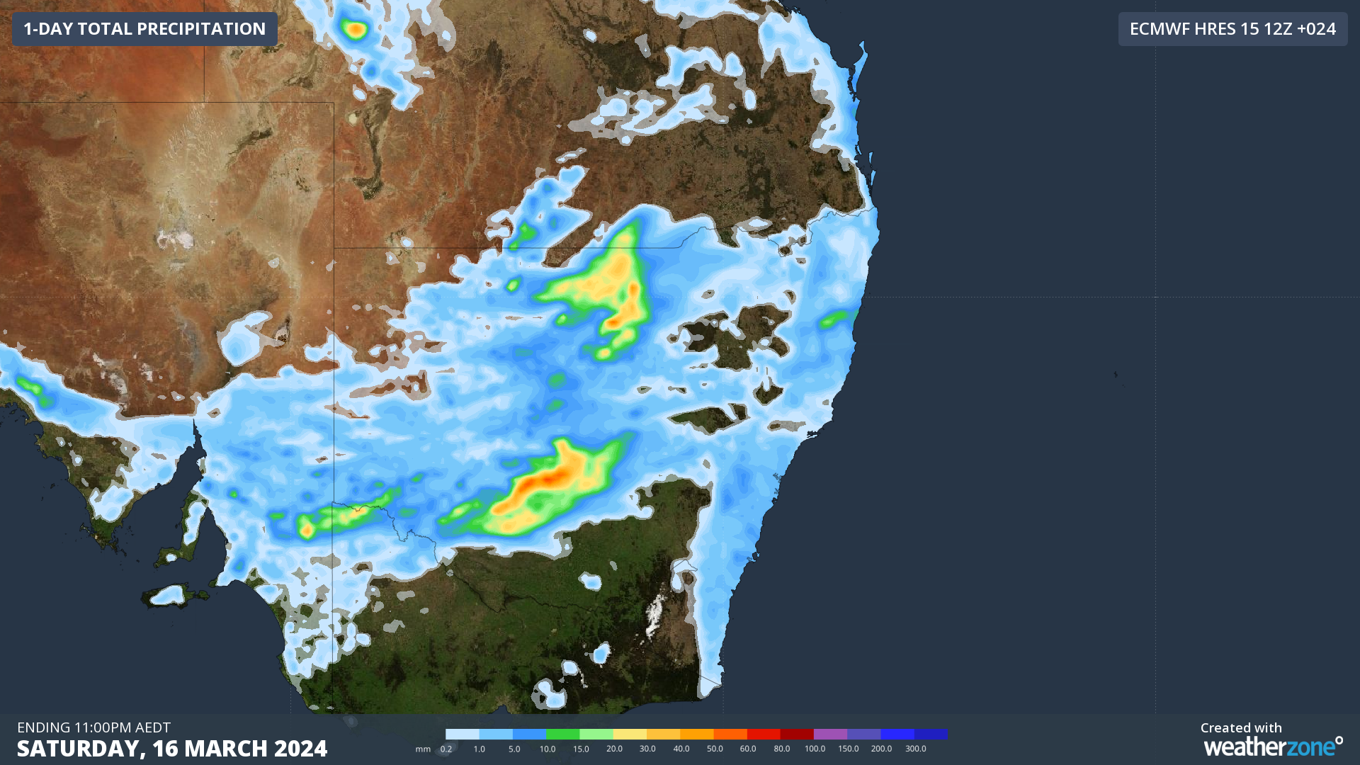
Image: forecast total precipitation for NSW and southeast Qld on Sat March 16th
So, inland NSW is where the highest rainfall totals for the eastern states will likely be, generally as a result of thunderstorm activity, with coastal areas only seeing up to 5mm on Saturday.
On Sunday, the weather should become less changeable as the inland trough makes its way towards the coast. Showers and storms will persist over inland NSW, but will also become more widespread over the NSW coast and increase over QLD, with the wet weather set to linger into the working week.