
Australia's heat engine firing up
WA's Pilbara region is sometimes referred to as Australia's heat engine because of the hot air generated there during summer, which is transported across the country by troughs and fronts.
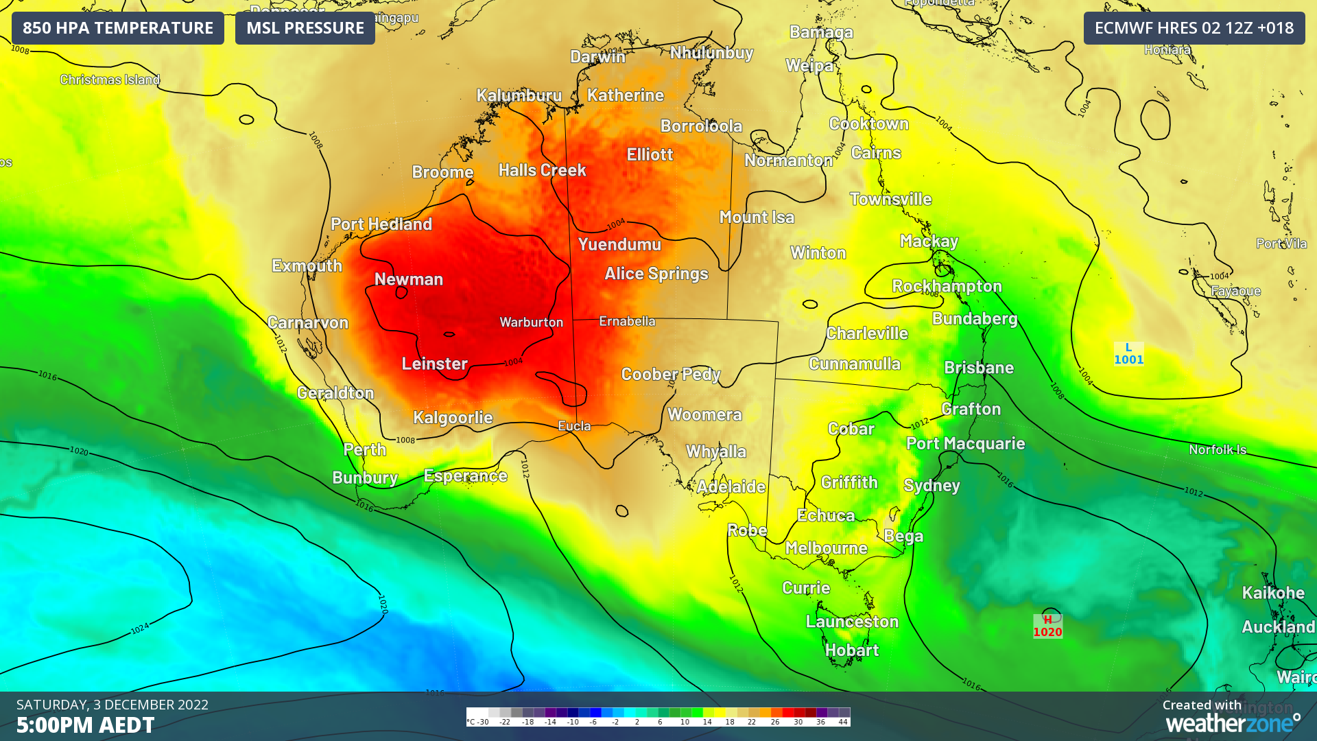
Image: Temperature at 850hPa (about 1.5km above the ground) and MSLP at 5pm AEDT Saturday 3rd.
The Pilbara is a desert region which makes it easier for the sun to raise the temperature of the ground compared to grassy or forested regions. This is because when moisture evaporates, it cools the nearby air – the way sweating helps cool our skin. A grassy or forested area can evaporate moisture from the soil and from plants. But with little moisture in the ground and little vegetation over the deserts, the sun can more easily raise the temperature of the ground, which then helps heat the air above it as seen in the image above.
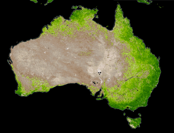
Image: Vegetation index on 1st December 2022 showing deserts and vegetated regions. Courtesy NASA.
Hot air from the northwest of Australia is transported to the southeast by winds blowing from the northwest ahead of troughs and cold fronts as they sweep across the country from west to east as seen in the following map.
That's what's happening this weekend as a trough and cold front begin to drag hot air from WA across central and southeast Australia.
Much of Australia just had a cold spring because the warm waters to the northwest of WA provided abundant moisture that led to thick cloud and heavy rain over southeast Australia. But now that the eastern Indian Ocean has cooled, less moisture is available to bring the cooling cloud and rain, so it's just hot dry air and clear skies ahead of the trough.
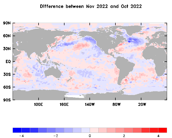
Image: Change in sea surface temperature at the end of spring. Courtesy Bureau of Meteorology.
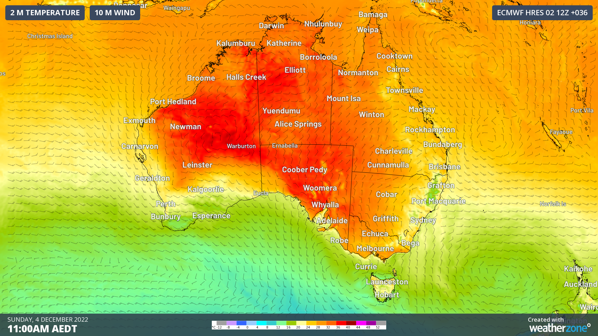
While inland towns will experience warmer conditions (above 35C and 40C), warmth will make its way to southern capital cities with Adelaide forecast to reach 33C today and 34C tomorrow, and Melbourne 31C today and 34C tomorrow. Winds will change to cooler southwesterlies behind the trough and front, and bring cloud cover, which will cool southeast SA and VIC on Monday and push the warm air northward. Adelaide is forecast to reach only 22C and Melbourne 20C on Monday, making for a large contrast in temperatures.