
A stormy start to the week for much of NSW
Widespread storms are possible for a large portion of New South Wales on Monday.
A broad low pressure trough will move across the state, bringing thunderstorms, rain and gusty winds at times. Storms are forecast to become more widespread from the afternoon into the evening, with some potentially becoming severe.
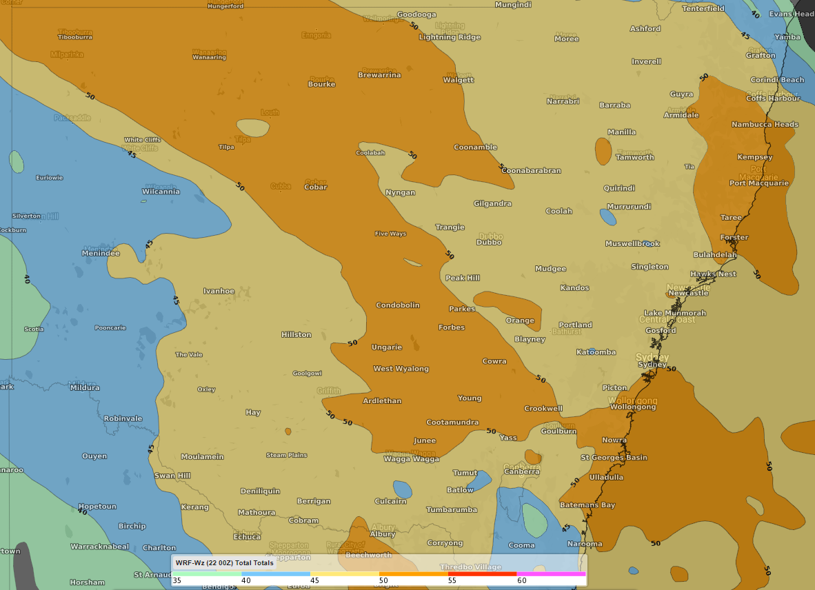
Image: Total totals shown across NSW for Monday 23rd at 2pm EDT. Total totals are one measure of thunderstorm potential and severity, with a value of 45 usually starting to give an indication of thunderstorm potential. Image from the WRF model.
The system looks to bring 24 hour rainfall totals of above 20-30mm to the southeast of the state and potentially around the Central Coast region by 9am Tuesday morning. Some decent totals may also be felt around central areas of NSW. Any thunderstorm however does bring the risk of heavy rain in short bursts, bringing the risk of flash flooding and a low risk of large hail.
A strong southerly will brush along the coast starting at the border with Victoria in the afternoon, reaching Sydney later in the evening. Conversely, strong northerly winds ahead of the system may affect the north coast from about Port Macquarie to the Queensland border.
Temperatures are expected to reach into the low 40's on Monday in the central north from Bourke to Moree, and into the mid-to-high 30's in the northeast, including Grafton and Lismore. Cooler temperatures will be felt in the south, from the mid 20’s in the southeast to near 30 degrees in the southwest and south central areas.