
A perfect recipe for wet weather
The stage is being set for an outbreak of wet and potentially severe weather over southeast Australia next week.
An area of high pressure currently centred over the Bight will slowly migrate over the Tasman Sea during the coming days; in the process, the high will transport low-level moisture across eastern Australia.
At the same time, a deepening trough presently situated in WA will gradually move east. This trough will encourage humid air over the warm waters to the north of Australia to glide towards the nation's southeast.
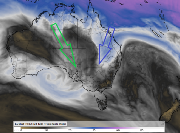
Image 1: precipitable water (a measure of the amount of moisture in the atmosphere) on Monday night according to ECMWF. The green and blue arrows represent moisture originating from the northern tropics and Coral Sea, respectively, moving towards southeastern Australia.
These two masses of moisture are expected to interact over eastern Australia from Tuesday.
However, this interaction of moist air on its own is not enough to drench the landscape. An unstable atmosphere is the next important ingredient that will allow this moisture to culminate in a soaking.
A third factor shall dictate where the largest rainfall totals and thunderstorms from this event will occur: The Great Dividing Range.
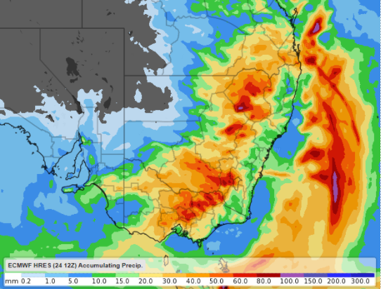
Image 2: ECMWF’s take on the amount of rain that is expected to accumulate by the end of the working week, with most falling between Wednesday and Friday.
The lion's share of the moisture will be kept on and west of the ranges, as the elevated terrain captures and forcibly condenses the moisture in the atmosphere.