
A last chance for a summery beach day in Sydney?
Following a grey, wet and riddled with pesky pandemic restrictions summer, Sydneysiders have generally missed out on enjoying the beautiful stretches of sand that dot our coastline.
Skies will gradually clear up over the city during Sunday, allowing the mercury to climb just above average to 27 degrees celsius. Tomorrow will see the mercury climb up to the low-30s, as heat is drawn in ahead of a low pressure trough.
Even with the promising temperature forecast, it will be important to make the most of the summer-like conditions early as this trough will also bring cloud cover, possible showers and the chance of a thunderstorm rolling into the afternoon and evening.
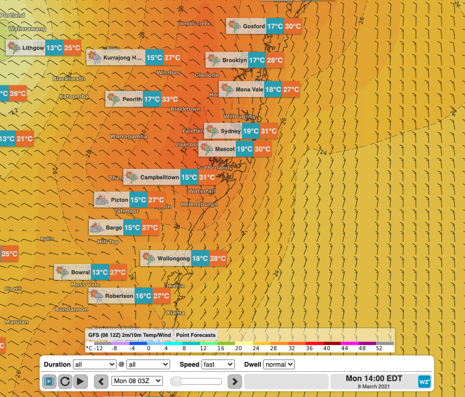
Modelled temperatures with winds in the early afternoon, along with daily forecasts, showing warm temperatures with light winds until the early afternoon, ahead of possible showers and thunderstorms.
In the water, a large southerly groundswell is currently bringing hazardous surf conditions to most beaches. Significant wave height with this swell reached an impressive peak of 4.9m in the late-afternoon yesterday at Eden, and 3.2m early this morning at Sydney, all with swell periods in the 15-16 second range. Combination of the large swell and longer period makes for particularly hazardous conditions as sets will be more infrequent, leading to long lulls in the surf. The longer period swell also carries much greater energy, resulting in lots of water moving about in the surf zone, bringing strong, sudden and deadly rips.
Luckily, the polar low with front which made a significant northwards progression, bringing this powerful swell, has been swept across the Tasman Sea, and wave height is on the decline following the overnight peak. The surf will remain large throughout Sunday, but should be a lot more manageable on Monday, especially at beaches protected from the south.
While the sea surface temperature currently sitting in the 23-24 degree range might not be as impressive as the balmy 25.7 degrees recorded on Friday (this being the hottest it’s been this summer/early-autumn), a dip in the brine may be a good idea ahead of the week of wet weather expected from Monday afternoon onwards.