
400km line of severe thunderstorms lashing southwest WA
A line of severe thunderstorms is moving onshore towards the southwest of WA, which could produce heavy rainfall and large hail on Thursday morning.
These thunderstorms are forming on a trough offshore ahead of an approaching cold front and sweeping across the region. The image below shows a shelf cloud over Bunbury on Thursday morning.

Credit:@the_greenhouse_goddess
Cape Naturaliste has recorded 12.2mm in the half an hour leading up to 8am WST on Thursday.
The image below shows a 400km long line of thunderstorms moving into the state’s southwest on Thursday morning, in a ‘train-like’ fashion as the storm cells follow each other's path.

Image: Himawari satellite image showing cloud, rain and lightning in the three hours leading up to 7:40am AWST on Thursday, May 2.
This movement thunderstorms is commonly known as the ‘train effect’, which is when thunderstorms and the associated heavy rainfall repetitively impact the same location.
This train effect could cause flash flooding in the region over the next few hours. These thunderstorms are also moving over a very dry landscape, which could increase this risk of flash flooding further.
The map below shows the forecast rainfall on Thursday, with widespread falls of 5-15mm forecast in the Central West, Goldfields, Central Wheat Belt, South West and Southern Coastal districts. Pockets of heavier rain are also possible.
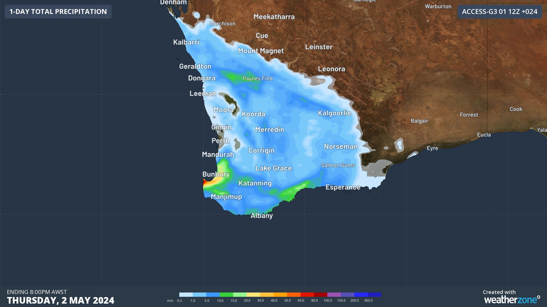
Image: Accumulated rainfall forecast for the day leading up to 8pm AWST on Thursday, May 2, according to Access-G
Looking ahead, rainfall should ease on Friday and Saturday across WA, however a low pressure system near South and South East Coastal districts on Sunday and early next week will bring another burst of rainfall to those districts.