
Windy night in Hobart

Damaging winds lashed parts of Tasmania last night, with gusts pushing above 100km/h in the state's capital city.
A strong air pressure gradient between a high pressure system centred in the Bight and a low to the southwest of New Zealand has been buffeting Tasmania with blustery southwesterly winds during the last 24 hours.
Last night, the wind increased further in parts of central and southern Tasmania as a cold front swept over the state.
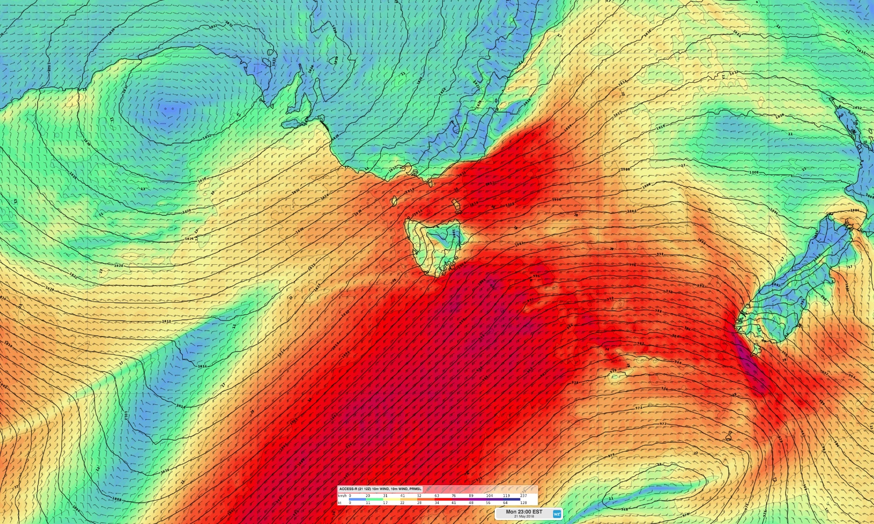
Image: ACCESS-R model data showing the strong pressure gradient between a high in the Bight and a low to the southwest of New Zealand.
Hobart registered a wind gusts of up to 113km/h, while gusts hit 145km/h at the top of Mount Wellington. This was the city's strongest gust in nearly two years.
There were reports of structural damage in Hobart as a result of the damaging winds, less than two weeks after the city was inundated by its heaviest rain in nearly 60 years.
Monday night's front also brought a burst of showers to parts of western and southern Tasmania, with 32mm falling at Strathgordon and 24mm at South Queenstown.
While Hobart was one of the windiest places in Australia on Monday night, the city missed out on the rain this time around.
- Weatherzone
© Weatherzone 2018