
Wild weather in the West
A strong cold front is crossing Western Australia, generating severe thunderstorms with tens of thousands of lightning flashes, howling winds, widespread rain, and rough seas.
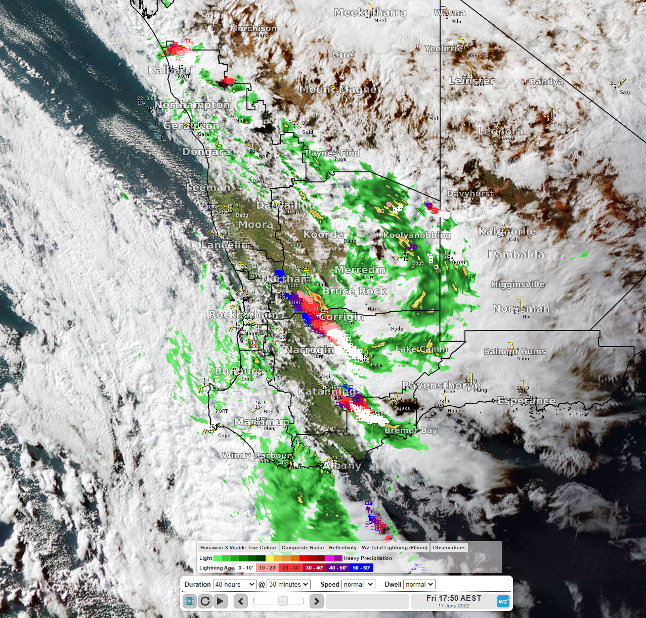
Image: Visible satellite imagery, radar and lightning at 3:50 pm WST June 17
Yesterday, the Bureau of Meteorology issued several Severe Thunderstorm Warnings for storms producing damaging wind gusts and heavy rainfall, including a warning for the Perth Metro. The storms commenced in the late morning and continued into the evening. There were 20,909 flashes of lightning recorded within 250km of Perth.
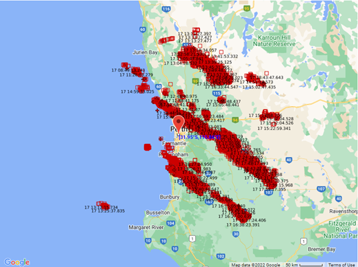
Image: Lightning flashes within 250km of Perth on June 17
While the threat of severe thunderstorms has passed, there will still be pesky showers, isolated flashes of lightning and rumbles of thunder, and howling winds across the southwest for the rest of the weekend.
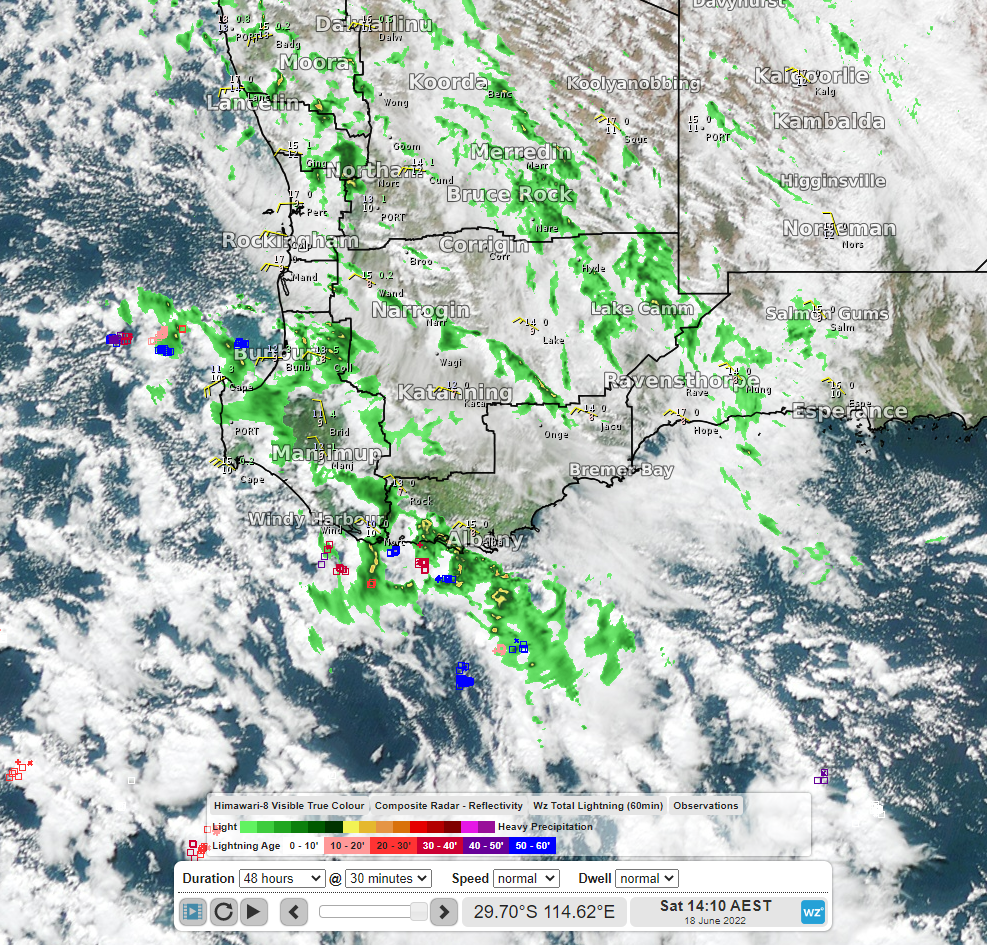
Image: Visible satellite imagery, radar and lightning at 12:10 pm WST June 18
Wind gusts will reach 70-80 km/h along coastal and elevated areas this afternoon and tomorrow. Cape Leeuwin has already recorded wind gusts of 93km/h early this morning.
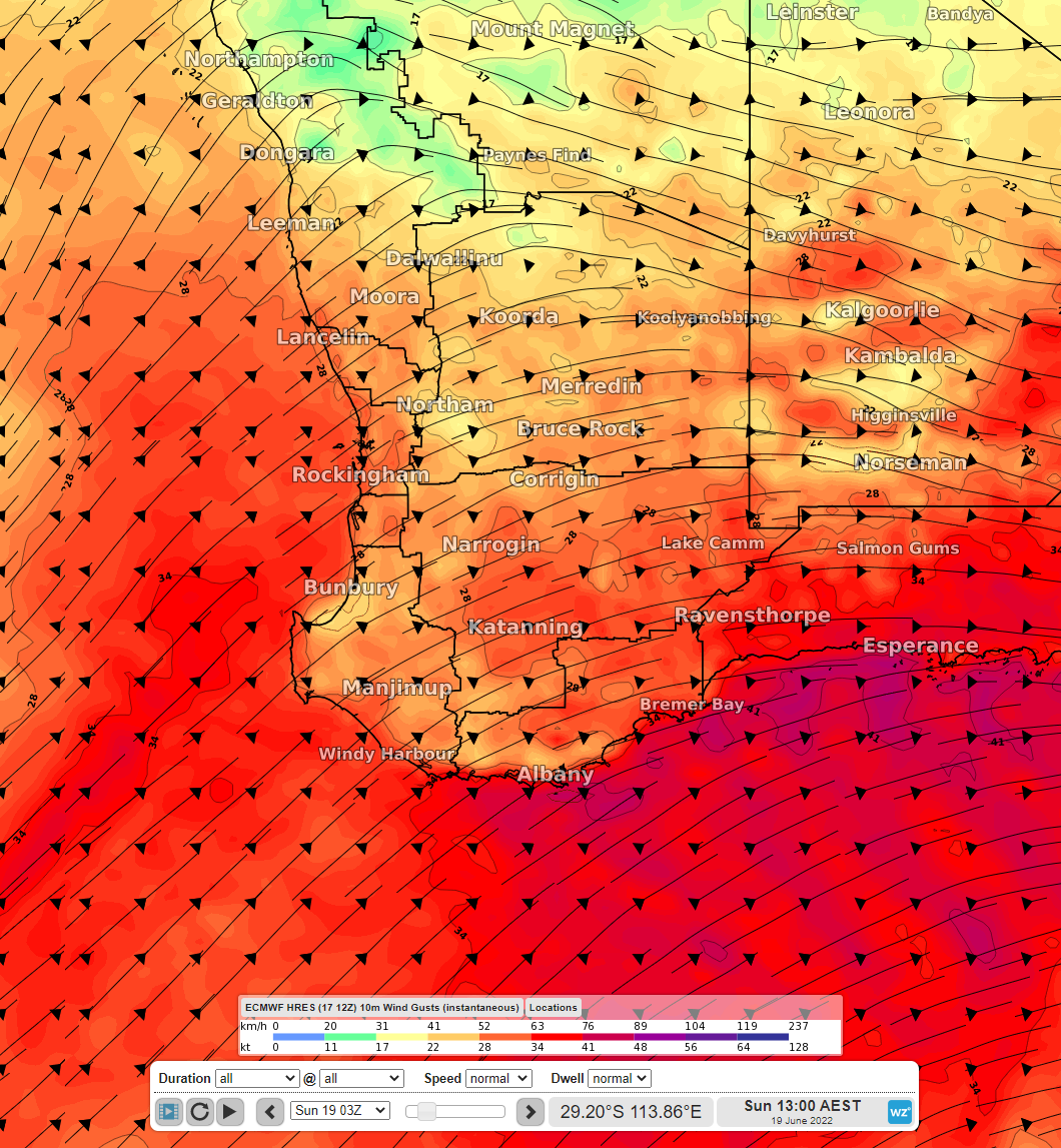
Image: Forecast wind gusts at 11:00 am WST June 19
Heavy swell will continue building in the wake of the front with significant wave heights reaching up to 5-6m tonight and tomorrow morning. This has forced the Rottnest Island ferry to be cancelled.
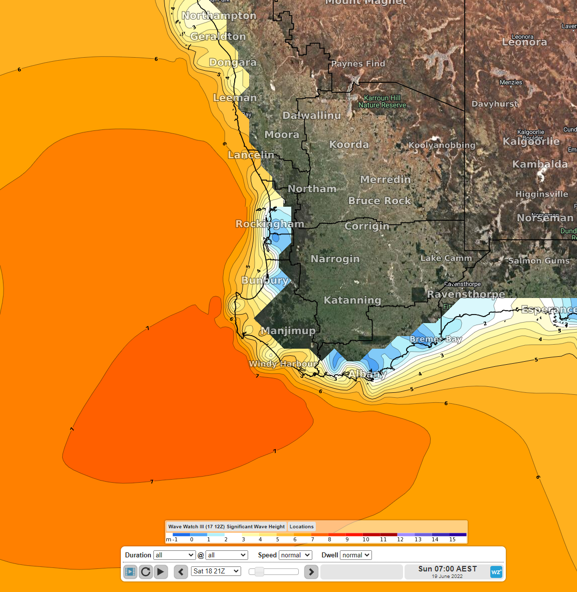
Image: Forecast significant wave height at 05:00 am WST June 19