
Tropical Cyclones Marian and Lucas yet to appear
Despite weather models picking two tropical cyclones developing off the coast of Western Australia in the Indian Ocean, they ended up weakening overnight and only remaining tropical lows.
If these tropical cyclone's developed they would've been named Lucas and Marian, but will now have to wait until the next cyclone forms off Australian waters.
Whilst the lows are weakening, the one that crossed the Pilbara coast overnight is bringing significant rainfall and gusty winds. Pardoo Station picked up 162 mm, Mandora 105 mm, both in 24 hours to 9am yesterday morning. Laverton and Barrow Island have felt wind gusts reach 39 km/h and 41 km/h as of 9am WST.
Rainfall totals between 100 and 200 mm and wind gusts up to 70 km/h may occur on Saturday across the Interior and eastern Pilbara as the low tracks to the southeast. As the low continues its movement towards the southeast, tropical moisture will be drawn into the system delivering significant rainfall across central parts of the country into early next week.
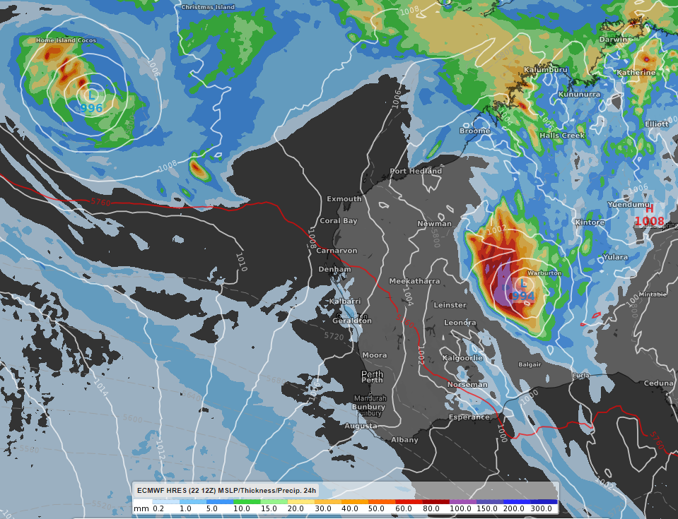
Image: The two tropical lows with mean sea level pressure and 24 hour accumulated rainfall to 2am WST Sunday 24th January 2021. Data used in the image from the ECMWF high resolution model.
The other low near the Cocos (Keeling) Islands is expected to track further south, although continuing to generate rain and storms over, and near, the Islands.
There are early indications of a tropical low developing off the Queensland coast late next week and next weekend, however, as with any forecasts there is uncertainty in regards to timing, strength and position.