
Rain spreading from Kimberley to Victoria as tropical moisture heads south
A mass of tropical moisture will pass over central and southeastern Australia this week, causing widespread rain and thunderstorms in multiple states and territories, including a large swathe of the Murray Darling Basin.
Moisture associated with Ex-Tropical Cyclone Esther will be carried towards southeastern Australia during the coming days by jet stream winds flowing high above Australia. This plume of moisture-laden air will interact with a broad trough of low pressure, generating rain and storms on multiple days along a corridor stretching from the Kimberley down to eastern Victoria.
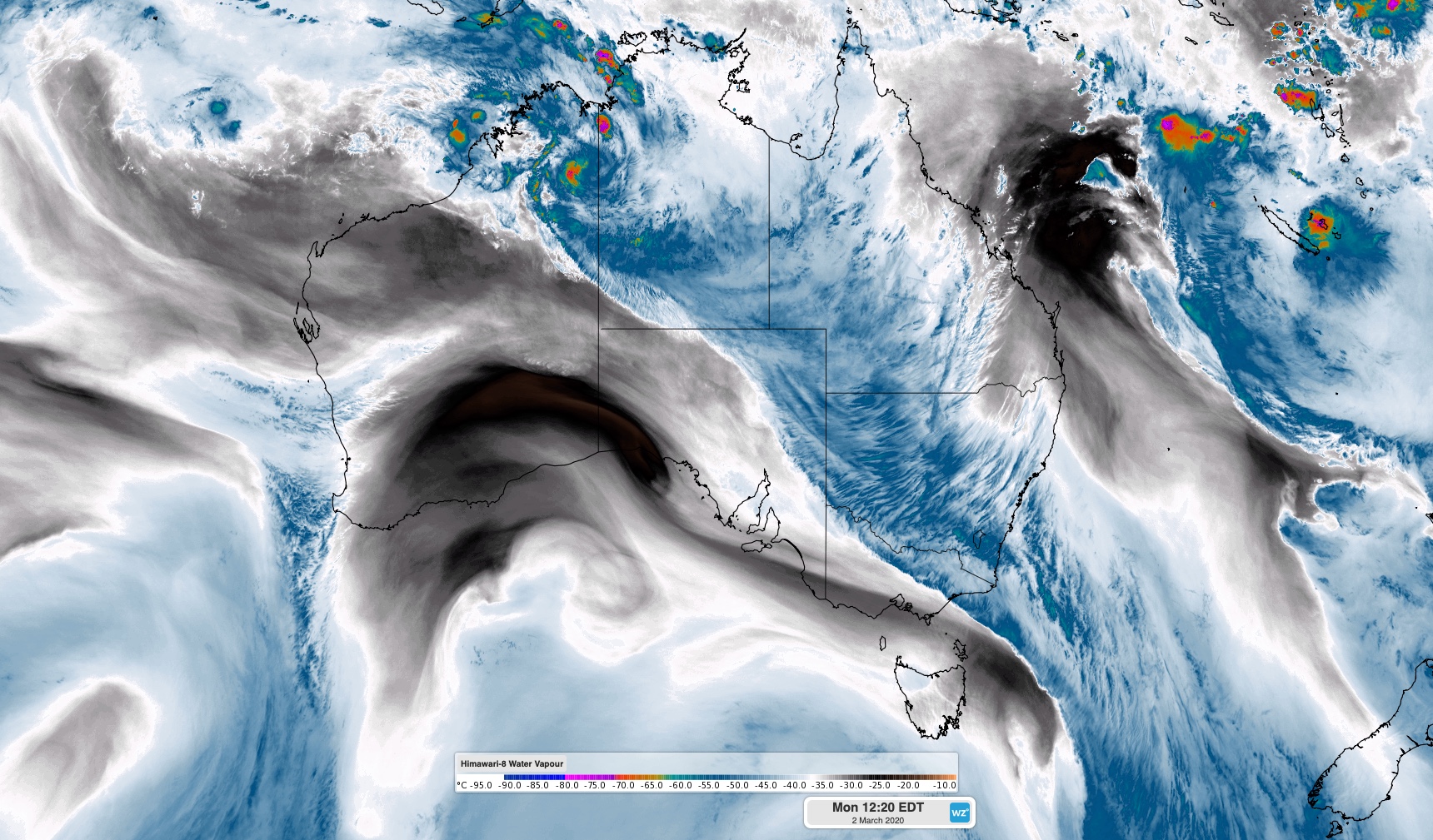
Image: Enhanced water vapour satellite image showing tropical moisture being transported across southeastern Australia on Monday.
Late last week, there was quite a bit of uncertainty regarding how this event would unfold. Now, models are in better alignment and we can start to get a better idea of where, when and how much rain will fall.
On Monday, showers will develop over parts of southern and central Australia, although the heaviest falls will occur around the NT-WA border, near Ex Tropical Cyclone Esther.
On Tuesday, rain will increase over the NT and central Australia, as showers and thunderstorms start to become more widespread in NSW.
On Wednesday and Thursday, a broad low pressure trough and the remnants of Tropical Cyclone Esther will move further east and south, causing widespread showers, thunderstorms and areas of heavy rain parts of Queensland, NSW, the ACT and Victoria.
Accumulated rainfall totals of 20-50mm are likely between now and Friday over a broad area stretching from the Kimberley down through central Australia, into western and southern NSW and down through northern, central and eastern Victoria. Some of this rain will also fall over Tasmania, most likely in the state's north and east.
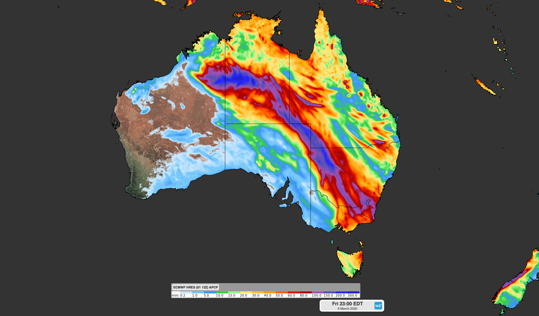
Image: Forecast accumulated rainfall between Monday and Friday this week according to the ECMWF-HRES model.
Some places could see more than 100mm from this system, particularly those directly impacted by thunderstorms.
As of midday on Monday, flood watches were in place for parts of the NT, WA and SA. Additional advisories and warnings are likely to be issued for this system over the coming days.