
Rain potential for Red Centre and Murray Darling Basin
The remnants of Tropical Cyclone Esther could spread rain through drought-affected areas of central and southeastern Australia during the opening week of March.
After causing widespread rain and thunderstorms over the northern half of the NT earlier this week, Ex-Tropical Cyclone Esther will spread flooding rain and potentially damaging winds through WA's Kimberley District between Friday and Monday. On Friday morning, flood watches and severe weather warnings were in place for parts of the NT and WA's Kimberly.
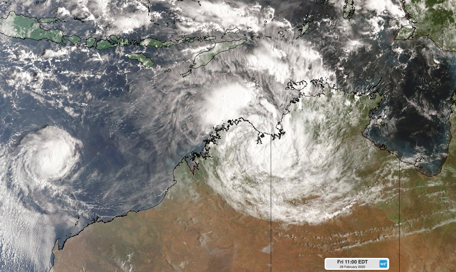
Image: Ex-Tropical Cyclone Esther located near the NT-WA border and Tropical Cyclone Ferdinand off the northwest coast of WA on Friday morning.
While there is good confidence in the movement of Ex-Tropical Cyclone Esther out to the start of next week, where it goes beyond Monday is more difficult to predict.
Some forecast models suggest that the remnants of Cyclone Esther will move towards the south or southeast, carrying a mass of tropical moisture across central and southeastern Australia mid-to-late next week.
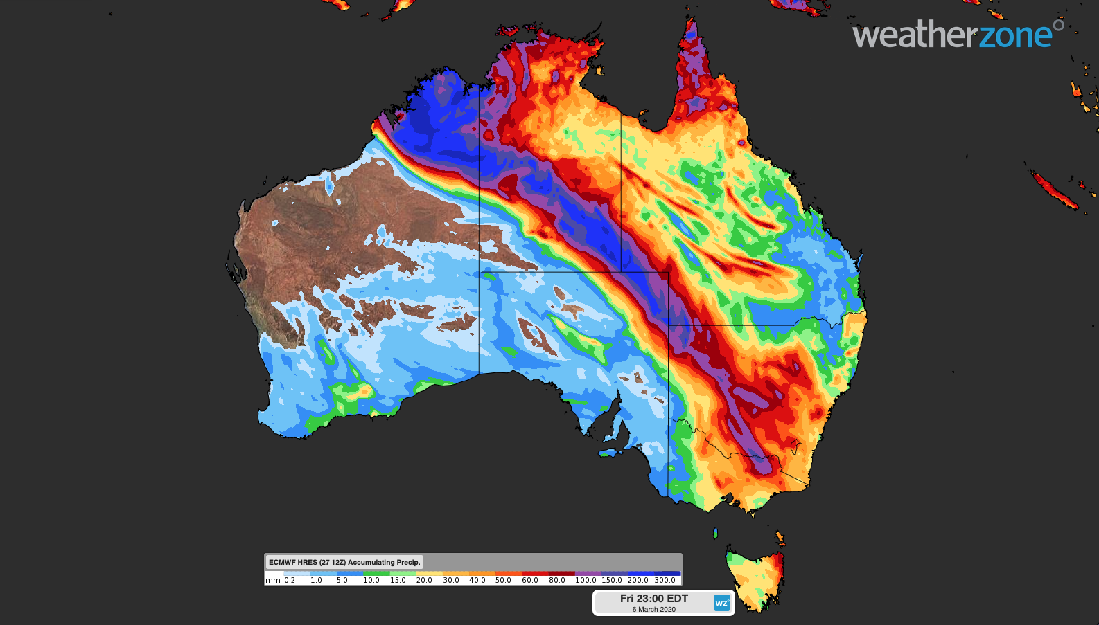
Image: Accumulated 8-day rain between Friday February 28th and Friday March 6th, according to the ECMWF-HRES model.
However, other forecast models indicate that the system could linger over northern Australia next week, keeping the tropical moisture in the tropics.
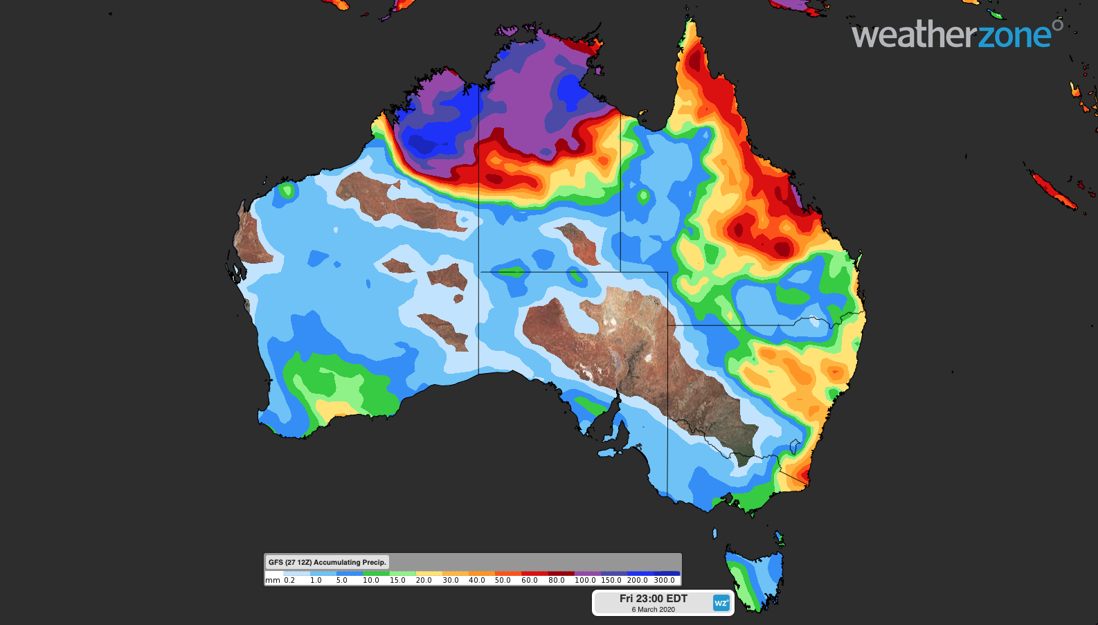
Image: Accumulated 8-day rain between Friday February 28th and Friday March 6th, according to the GFS model.
While the current spread of possible future scenarios offers some hope for drought-affected areas of central and southeastern Australia, it's still too early to know what will happen. The movement of Ex-Tropical Cyclone Esther during the opening week of March will ultimately decide where, when and how much rain falls from this system.
Expect forecasts for your location to jump around a bit from day to day as more accurate model information becomes available.