
Morning fog blankets parts of NSW and ACT

Parts of New South Wales and the Australian Capital Territory were greeted with a thick fog on Saturday morning thanks, in part, to a slow-moving high pressure system.
The lingering high pressure system brought light winds and clear skies, which allowed for sufficient nocturnal cooling. This, combined with ample moisture at the surface, allowed for the development of dense fog to parts of NSW and the ACT.
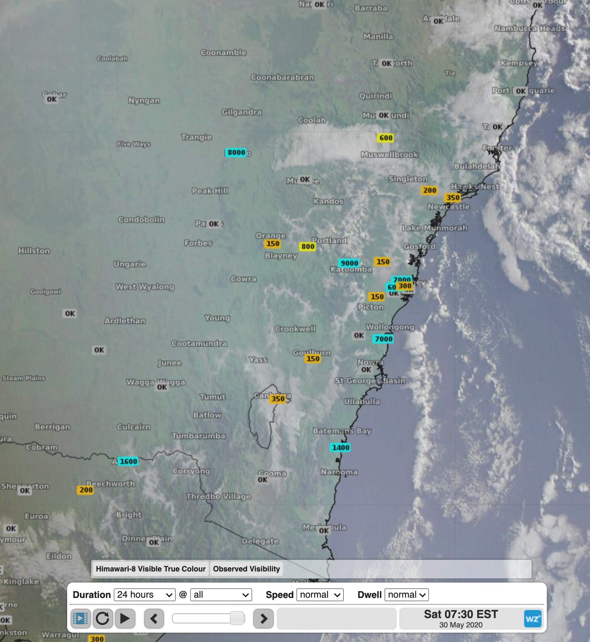
Image: Visible satellite image showing fog over NSW and ACT on Saturday morning
Goulburn Airport had some of the thickest fog with visibility dropping down as low as 50m in the early hours of Saturday morning. Elsewhere, visibility dropped to 100m in a number of locations including Albury, Maitland, Bathurst and Scone, 150m at Cooma and 200m at Williamtown.
In Sydney, fog was most widespread and thickest in the western suburbs. Camden, Canterbury and Richmond all dropped to a visibility of 100m and Bankstown dropped to 120m. This fog triggered the issuing of the Road Weather Alert for reduced visibility early on Saturday morning, which has now been cancelled.
The nation's capital didn't escape the fog either. Visibility at Canberra Airport remained below 800m from midnight until well after sunrise, dropping as low as 120m at dawn.
Much of the fog has now lifted to reveal a sunny Saturday morning, and a warm day ahead.