
La Nina making its presence felt
The southeast of the country is today witnessing what a La Niña summer looks like, with widespread storms, showers and strong winds forecast from South Australia across to Victoria and New South Wales.
A vigorous trough is crossing the southeast, currently situated near the Victorian-South Australian border, and brought wind gusts close to 100km/h about elevated areas this morning. The trough is providing instability for storms to form to its east, which are being enhanced by the deep moisture that has accumulated over NSW after days of easterly winds.
Storms currently over the Lower West and Central West Slopes and Plains and Central Tablelands are likely to intensify this afternoon as the trough moves closer. The trough will then likely steer some storms over the coast - most likely north of the Illawarra - this evening.
A Severe Thunderstorm Warning is current for a large part of the north and east of the state, with damaging winds, very heavy rain and (in the west) large hail possible. Warnings will be monitored and updated throughout the afternoon.
The coalescing storms are also expected to produce widespread rainfall this afternoon and evening about the South West Slopes, Central Tablelands and Central West Slopes and eastern parts of the Central West Plains.
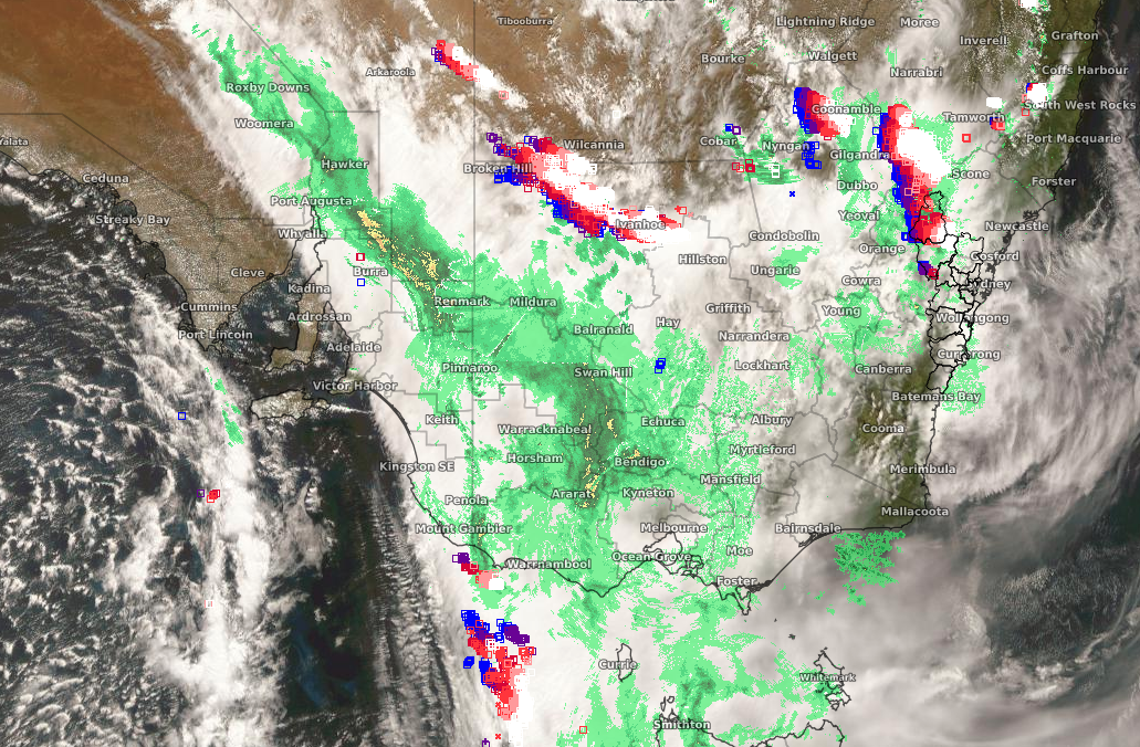
Image: Satellite picture for 1300 EDT 5/12/20, showing a vigorous trough near the SA/NSW and SA/VIC border and showers and storms forming to its east.
Following the change, another surge of cooler air will cross the southeast on Sunday, bringing unseasonably cool temperatures to start the new week.
Canberra is forecasting 20 and 19 degrees on Monday and Tuesday, 6 and 7 degrees below average respectively, while Melbourne is forecasting back to back days of 19, 5 degrees below average. Sydney will take longer for the cool air to establish, and after a very warm Sunday and Monday will reach only the low to mid-twenties on Tuesday and Wednesday.
The situation is a far cry from this time last year, when heat waves and fires were already dominating the headlines. Increasing tropical storm activity over the coming week may provide the moisture for another rain event over the eastern inland late next week.