
Central WA welcomes a little rain, with more possibly on the horizon
The couple of millimetres of rain that is falling in parts of Western Australia may not seem like much, but for some areas which do not get a whole lot of rain, like in central Western Australia, it is a very welcome sight. Particularly when this rainfall could extend into the coming week.
A low-pressure trough that is being fed moisture from the Indian Ocean has sparked up some showers and thunderstorms over parts of Western Australia and could stick around well into the coming week.
The sparsity of weather stations in central Western Australia means that only a few locations have officially recorded rainfall since 9am on Sunday, those being:
- Degrussa Aerodrome with 1.6mm
- Golden Grove & Leonara Airport with 0.8mm
- Wiluna with 0.4mm
Leading up to 9am Sunday, some rain also fell at:
- Mount Clere with 1.2mm
- Burringarrah Airstrip with 1.2mm
- Ginginjibby with 0.4mm
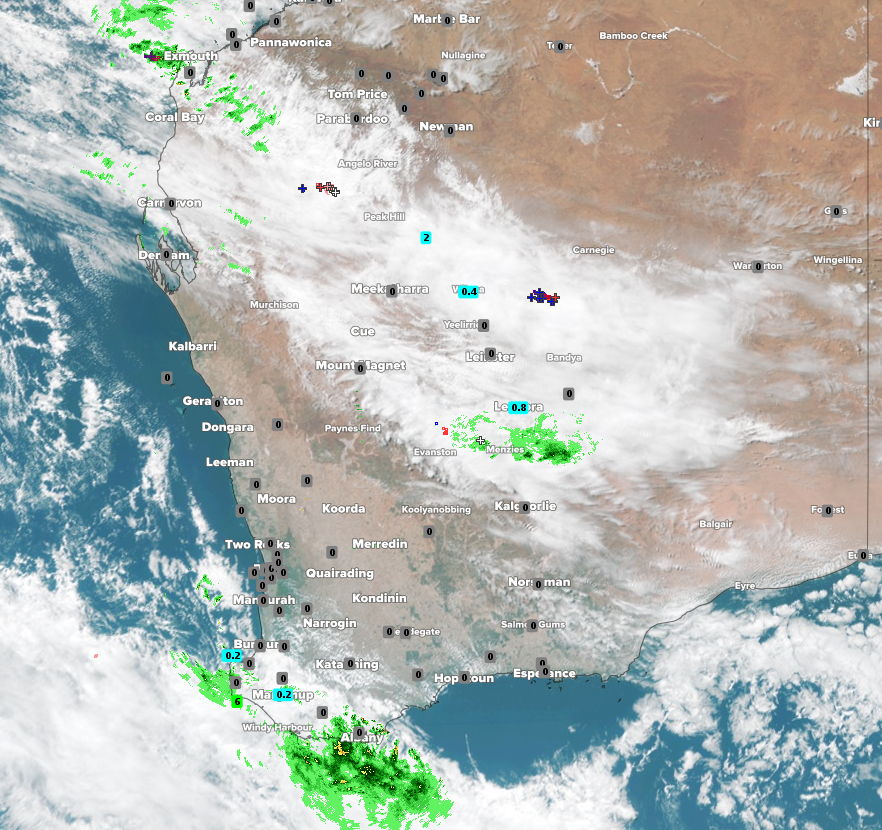
Image: Satellite (Himawari-8) with Radar, WZ Total Lightning and recorded rainfall at 12pm WST Sunday 9am showing thick cloud producing showers and thunderstorms over WA
Places like these do not typically see too much rain at this time of year with Leonara only having about 3 days of rain on average in May with an average total of just under 9mm. However, the forecast looks favourable for some of these locations to get some decent rainfall totals over a couple of days.
The rain-bearing trough should stick around on Monday to bring more rainfall, especially in the Gascoyne region but also spreading to the southeast of WA. Tuesday looks to be the peak day rain, with widespread falls of 20mm possible in the Gascoyne area and lighter falls spreading into southeastern areas. On Wednesday, the focus of this rainfall will shift further east to inland areas, although will be less intense before drying out on Thursday and Friday.