
Wintry weather on the horizon for southeastern Australia
Rain, thunderstorms, damaging winds, snow and hail could all affect southeastern Australia during the second half of this week.
A low pressure trough interacting with moisture-laden air and an unstable atmosphere will cause rain and thunderstorms over parts of SA, NSW, the ACT, Victoria and Tasmania between Wednesday and Friday.
The rain from this system will be widespread and some places will see wet weather on multiple days. Parts of inland NSW, northern Victoria and northeast Tasmania could receive more than 50mm by the end of Friday. This system may also produce severe thunderstorms.
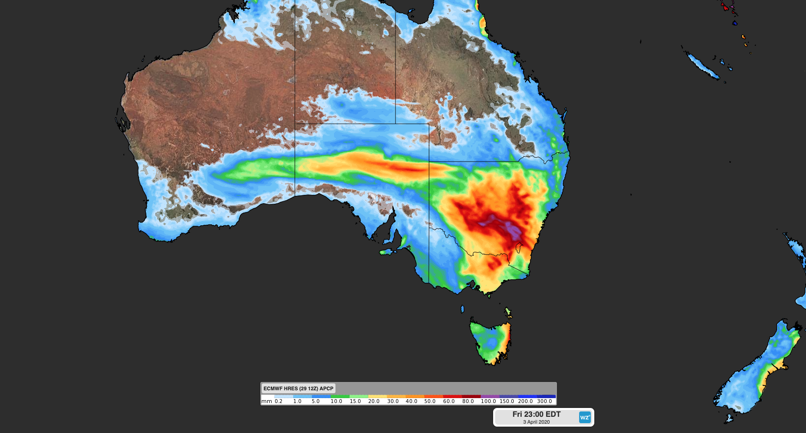
Image: Forecast accumulated rain between Monday and Friday, according to the ECMWF-HRES model.
Later in the week, a complex low pressure system will pass over Tasmania and send a surge of cold air across southeastern Australia. This system will produce showers, thunderstorms and blustery winds in parts of South Australia, Victoria, Tasmania and southern NSW between Friday and Sunday, with some places likely to see hail, snow and damaging winds.
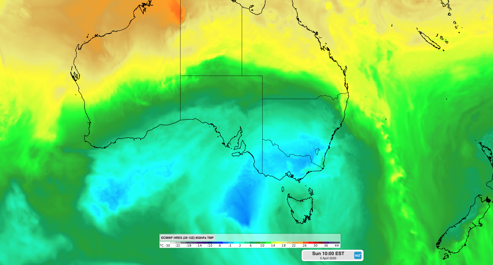
Image: Modelled temperature at the 850hPa level (around 1500 metres above sea level) on Sunday, according to the ECMWF-HRES model.
Parts of southeastern Australia are likely to see their coldest weather so far this year towards the end of this week. Melbourne's forecast top of 16 degrees on Sunday would be the city's coldest day since December.