
Wind, rain, thunderstorms and low temperatures for southwest WA
A cold front, low pressure and a cold air mass will bring a mix of conditions to southwest Western Australia over the next week.
The cold front is expected to cross the region on Sunday morning, with an associated low pressure system developing and remaining over the area until about Tuesday/Wednesday before moving east into South Australia. The front and low will draw in moisture from the north allowing rain to fall along mostly coastal areas from Carnarvon to Eucla during the next few days. At this stage, the heaviest falls are expected across the southern coast from about Albany to Israelite Bay, with some areas potentially seeing over 50mm accumulated totals.
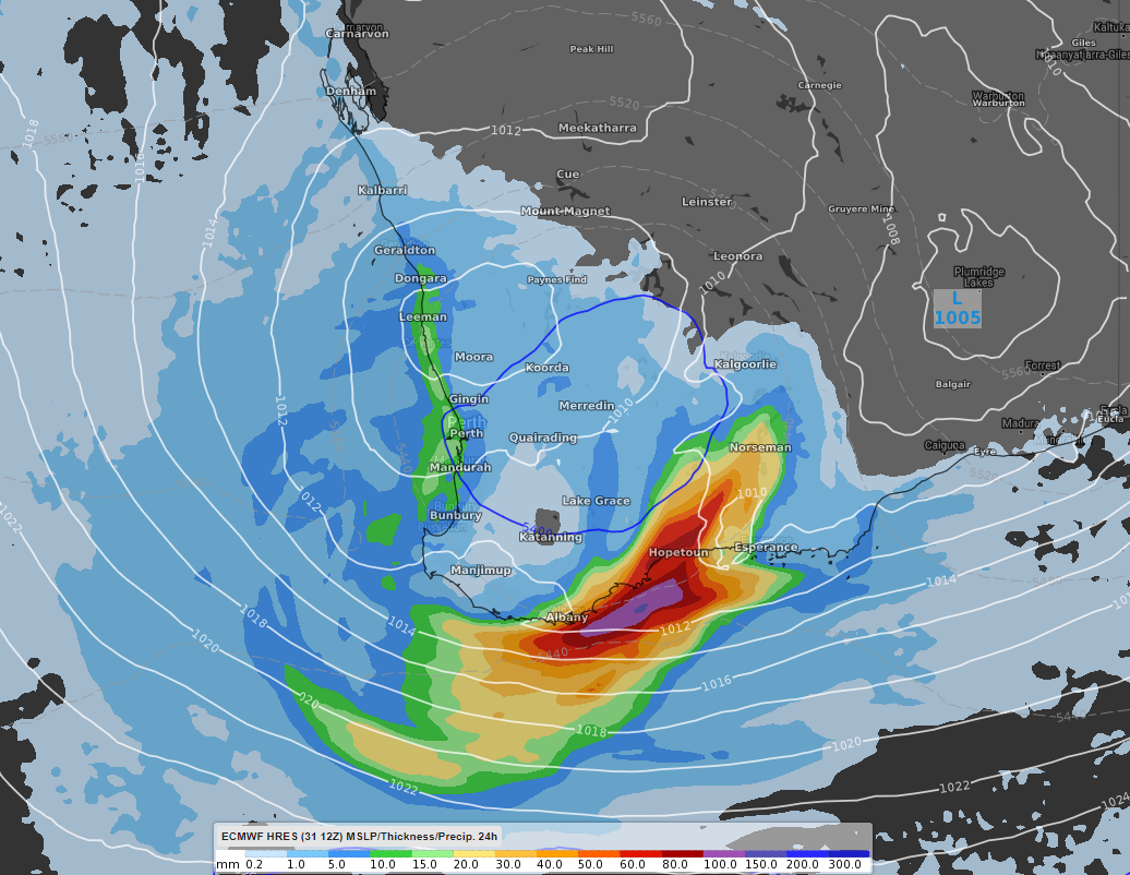
Mean Seal Level Pressure (white lines), pool of cold air (blue line) and 24hour accumulated rain to 5am WST Tuesday 4th August, displayed using the ECMWF model
Strong winds are likely with this system across similar areas to the rain and the strongest areas being coastal. These winds are likely to strengthen from Sunday afternoon, with the strongest being from an east to south east direction across the southern coast on Tuesday and Wednesday. Westerly component winds will also affect the southwest coast but expected to be slightly weaker than the southern coast winds.
Isolated thunderstorms are also a risk each day until about Wednesday. Amongst these storms, hail has the potential to develop.
Large areas across the southwest will at least experience one or two days of below average overnight and daily temperatures with the passage of this system. Combined with lower than average temperatures, wind chill will make temperatures feel potentially up to four degrees colder than the actual.
An interesting feature of the conditions is the slight potential to bring snow to elevated areas in the far south, around the Stirling Ranges and to a lesser extent, elevated areas within the Porongurup National Park. At this stage, there is a low chance for snow to fall and if it does, it looks to be around Monday evening or Tuesday morning.