
Will this week's dual cyclones break eastern Australia's drought?

A tropical cyclone and a mid-latitude cyclone will jointly cause widespread rain and thunderstorms across eastern Australia during the next few days.
While this event will bring severe weather and flooding in spades, it will also bring some welcome moisture to parched soil in drought-affected parts of eastern and southeastern Australia.
So, will this rain event break the drought?
Swathes of western NSW and adjacent parts of inland Queensland, SA and Victoria have endured severe rainfall deficiencies during the last 11 months. The Murray Darling Basin just experienced its seventh-driest January to November period in more than 100 years of records.
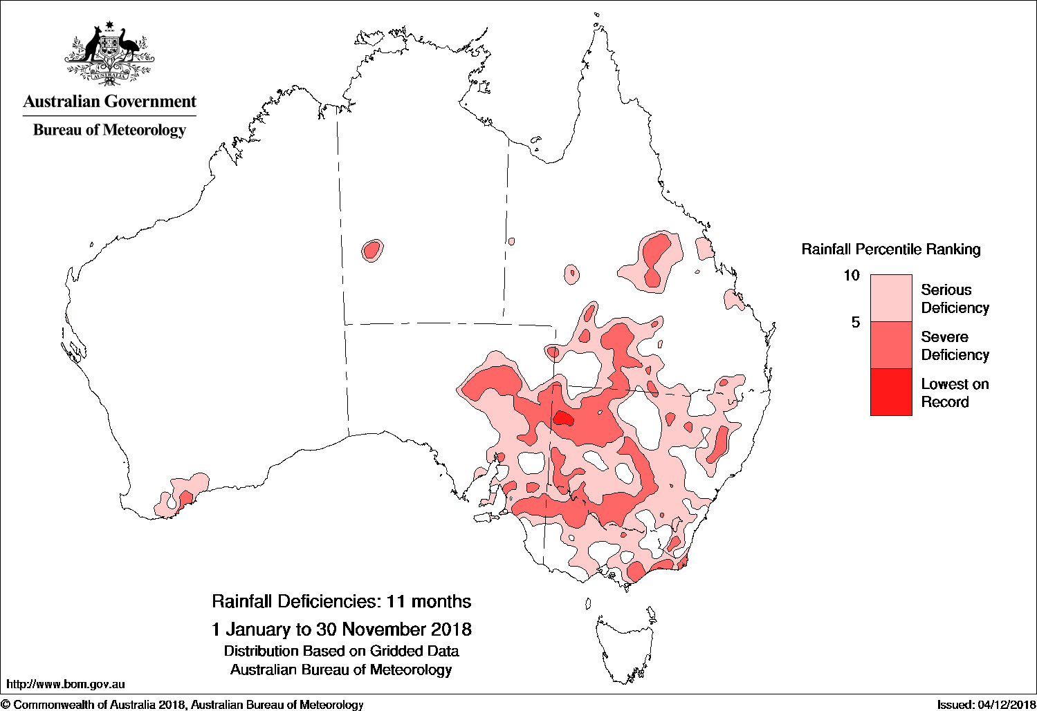
Image: Year-to-date rainfall deficiencies as of November 2018. Source: BoM
The dry year-to-date continues a longer trend of below average rainfall across much of eastern and southeastern Australia. As of last month, the total accumulated rainfall during the last two years was in the lowest 10 per cent of historical records for most of NSW, eastern Victoria and central and southern inland Queensland.
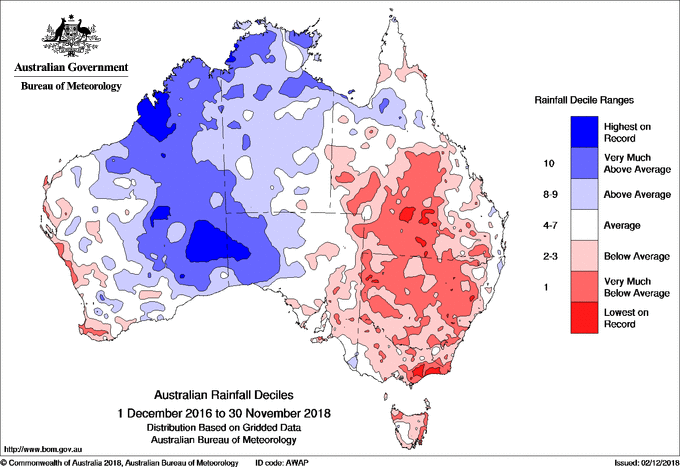
Image: Accunulated 24 month rainfall deciles as of November 2018. Source: BoM
But how much rain has failed to fall?
As of 9am on December 12th, year-to-date rainfall totals were more than 200mm below the annual average in most of Victoria, NSW and Queensland. Some eastern parts of each state were lagging their annual rainfall averages by more than 400mm.
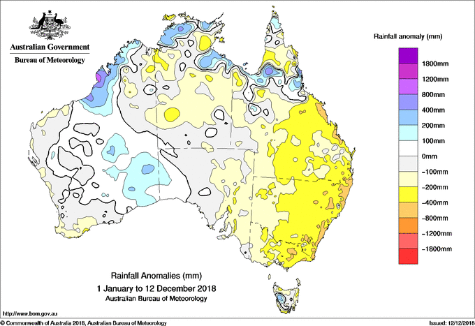
Image: Year-to-date annual rainfall anomalies as of December 12th, 2018. Source: BoM
On a longer time-scale, many areas of eastern Australia need more than 300mm to eradicate their two-year rainfall deficits, while some require more than 600mm to just break even.
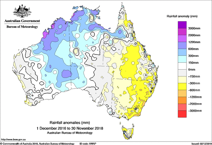
Image: 24-month rainfall anomalies as of November 2018. Source: BoM
Over the next week, widespread falls of 20-50mm are likely in Tasmania, Victoria, NSW and Queensland, with some areas likely to see more than 100mm and isolated places expected to collect a few hundred millimetres.
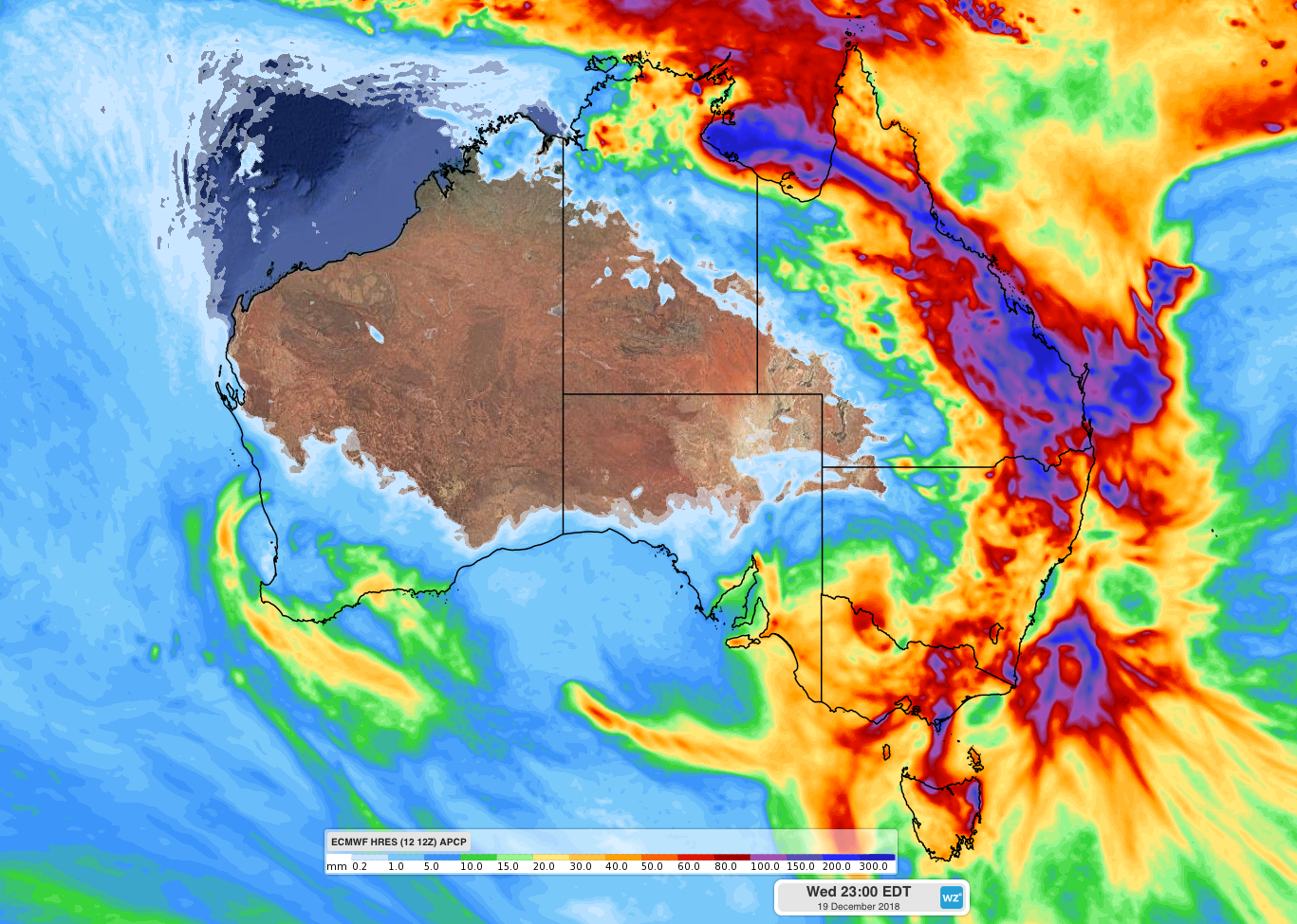
Image: Predicted rainfall for the week ending on Wednesday December 19th by ECMWF model.
The impending rain produced by Tropical Cyclone Owen and the mid-latitude cyclone should ease, and in some cases remove, the short-term rainfall deficits over parts of Queensland, NSW and Victoria. However, this rain event will put less of a dent in the longer-term rainfall deficits across eastern Australia.
The term 'mid-latitude cyclone' is a technical name given to any low pressure system with a closed circulation that exists in the mid-latitudes.