
What to expect from a cyclone like Owen

Tropical Cyclone Owen is strengthening over the Gulf of Carpentaria and is expected to travel over eastern Queensland during the coming days, potentially causing widespread severe weather in a number of populated areas.
To know what kind of weather Owen may bring, it helps to look back at other tropical cyclones that travelled over Queensland in a similar way.
Since 1970, there have only been two other cases where tropical cyclones from the Gulf of Carpentaria have moved over, or near, eastern Queensland and made it as far south as Rockhampton.
In late January 2013, Tropical Cyclone Oswald formed over the Gulf of Carpentaria before crossing the west coast of Cape York Peninsula near Kowanyama as a category one system. Oswald then spent the next week travelling southwards across the eastern inland of Queensland and NSW as a low pressure system, below cyclone strength. The remnants of Oswald eventually moved back off the coast of NSW near Sydney on 29th January, eight days after it made landfall in far northern Queensland.
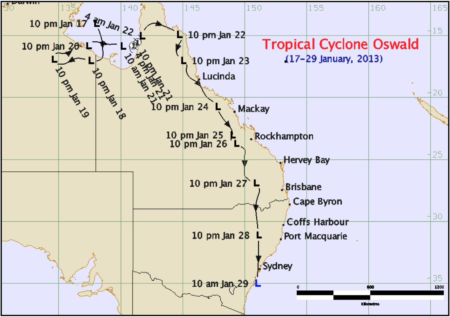
Image: Track map for Tropical Cyclone Oswald. Image: Bureau of Meteorology
While Tropical Cyclone Oswald remained below cyclone strength as it traversed eastern Australia, it left a trail of major flooding and wind damage in its wake. Widespread rainfall totals of 200-400mm were recorded between Queensland's North Tropical Coast and the Illawarra District in NSW during this week-long event, with some places receiving more than 400mm in just 24 hours. The highest daily rainfall total was 744mm at Upper Springbrook in southeast Queensland and some rivers experienced record major flood peaks. A few weather stations registered wind gusts above 100km/h and a number of tornadoes and waterspouts were reported during the event.
Oswald's prolific rainfall was caused by the system's unique path across eastern Australia. By staying over land but remaining close enough to the coast, the ex-tropical cyclone was able feed off moisture-laden air from the Coral and Tasman Seas, maintaining a continuous stream of fuel for rainfall.
One important feature of Tropical Cyclone Oswald is that it occurred after the 2010-12 La Nina event, which was one of the strongest La Ninas on record. As a result, river catchments in eastern Australia were more saturated leading up to Oswald's arrival than they are now.
The other case of a Gulf of Carpentaria tropical cyclone travelling over eastern Queensland and reaching Rockhampton was Tropical Cyclone Fiona in February 1971. Fiona made landfall near Kowanyama as a category three severe tropical cyclone before tracking across eastern Queensland and moving back off the east coast near Rockhampton. The system lingered near the Capricornia coast for another day before heading out into the Coral Sea. Tropical Cyclone Fiona caused minor to major flooding in the Burdekin and Fitzroy Basins, which cut off roads for a number of days. Wind caused damage to crops and infrastructure, while a tornado destroyed a house near Sarina.
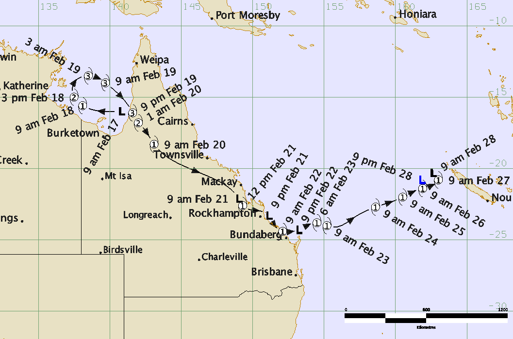
Image: Track map for Tropical Cyclone Fiona. Image: Bureau of Meteorology
While it's rare for tropical cyclones to travel from the Gulf of Carpentaria down to southeast Queensland, a number of cyclones have traversed eastern Australia after approaching Queensland from the Coral Sea. Some recent examples were Severe Tropical Cyclone Marcia in 2015 and Severe Tropical Cyclone Debbie in 2017, both of which caused more than 300mm of rain in six hours in some places.
Every tropical cyclone is unique and so is the weather they produce. Tropical Cyclone Owen is expected to make landfall over the west coast of Cape York Peninsula on Friday and become one of only three Gulf cyclones to travel over eastern Queensland and move south of Rockhampton. Based on computer model guidance and past examples of similar system, Owen is likely to cause a high impact weather event that will affect a large portion of Queensland's population and possibly parts of northeast NSW as well.
Visit http://www.bom.gov.au/cyclone/index.shtml for the latest information on Tropical Cyclone Owen.