
Wet relief for Darwin

The Wet Season is not officially here but an interlude of storms over the coming few days will bring some relief to the unrelenting humid heat, as well as a much needed top up to the local water supply.
After a record breaking 113 mm in October that all fell in one day, the city's been rain free, hot and humid. Daytime temperatures for November are averaging 2 degrees above the long-term 1941-2016 average, an absolutely massive amount for the consistent tropics. Many of those days have also seen humidity above 50% which is enough to make a southerner melt.
Afternoon and evening storms the last few days have injected some refreshing (albeit brief) periods of cool. Overnight Saturday/Sunday and Sunday/Monday should see further cool periods as afternoon storms forming over the Arnhem Land Escarpment are steered west towards Darwin.
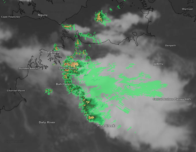
Image: Satellite and radar imagery showing storms approaching Darwin before dawn on Saturday 21st November, 2020.
From Wednesday, showers and storms will become even more likely as highly moist northwest winds continue. This is good news also for Darwin River Dam, which is down to a capacity of 50%, the lowest level since 2005.
Beyond this week, tropical monitoring predicts an active wet period for the Top End around the first week of December. Combined with the well-publicised La Niña conditions in the tropical Pacific, many are waiting for an early onset to the Wet sometime next month.