
Waves building after windy night in southeastern Australia

Surf is building along the NSW coast this morning after wild winds lashed parts of southeastern Australia overnight.
A strong cold front passed over Tasmania and Victoria on Wednesday night, producing wind gusts of close to 150km/h in some areas.
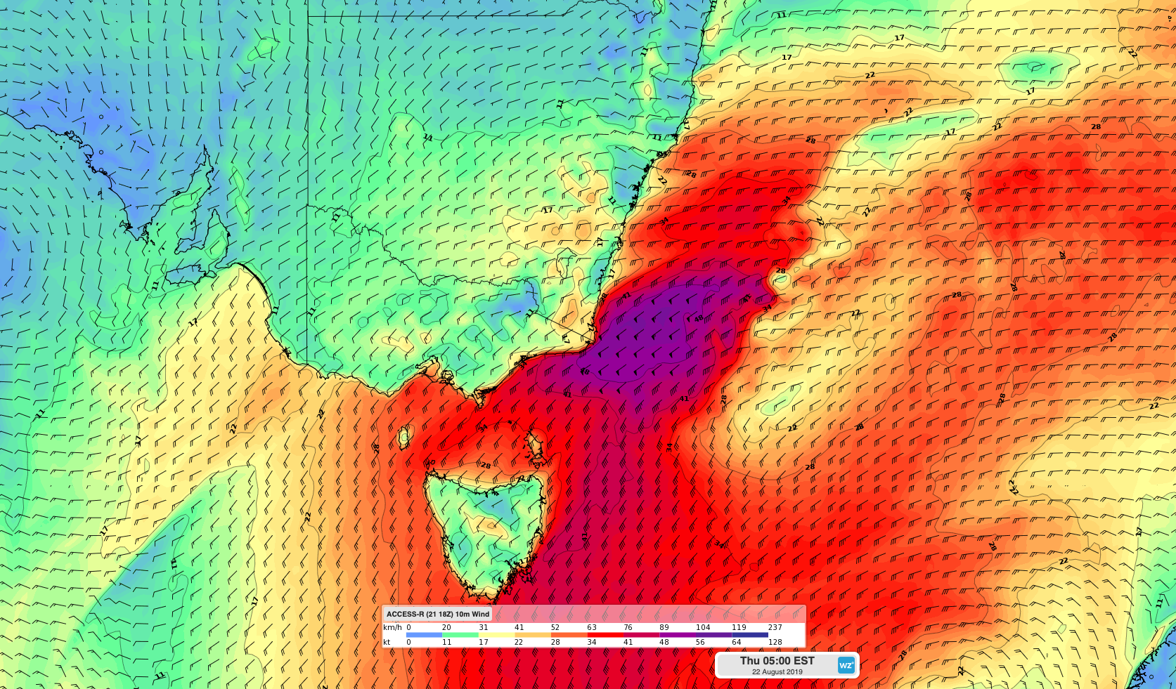
Image: Forecast surface wind speeds on Thursday morning.
In Tasmania, gusts reached 132km/h at 10pm on Wednesday as snow fell to low levels in central and southern parts of the state. Snow was estimated to have reached around 400 metres above sea level early on Thursday morning.
Wilsons Promontory in southern Victoria clocked a gust of 143km/h shortly before 2am on Thursday as wind roared across Bass Strait. As the front moved further east, a gust of 135km/h occurred at Gabo Island just before 8am, which is the highest gust recorded at the site since at least 2007.
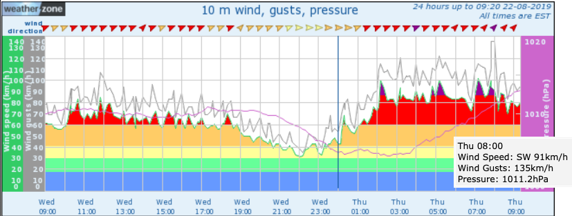
Image: Gabo Island wind observations, showing a gust of 135km/h at 8am.
The front will cause a blustery southerly change to sweep up the NSW coast and ranges on Thursday, reaching Sydney around midday and the Queensland border by the early evening. This northward progression will allow winds to gradually ease in Tasmania and Victoria throughout the day.
As of 9am AEST, severe weather warnings for damaging winds were still in place for parts of Tasmania, Victoria, NSW and the ACT.
The system will gradually lose some puff as it heads north, so the gusts seen in Bass Strait this morning aren't likely to be witnessed in Sydney. However, damaging winds are still possible across a broad area of eastern NSW during Thursday.
In addition to the wind, a pulse of large and powerful surf will develop rapidly along the NSW coast on Thursday. While conditions were seemingly benign at some beaches on Thursday morning ahead of the approaching front, conditions will quickly deteriorate as the change passes through.
The average wave height off the coast of Batemans Bay rose from 2 metres at 5am to 3.4 metres at 8am, with maximum wave heights exceeding 5 metres.
Average wave heights could reach 5-6 metres along central and northern parts of the NSW coast on Thursday afternoon and evening, with the biggest surf expected to hit south-facing beaches. Coastal activities like swimming and rock fishing should be avoided today.