
Unsettled spell for WA

A slow moving low will bring a period of wet and windy weather to Western Australia over the next few days.
The initial front and trough will push in from the west on Sunday, and will draw in tropical moisture from the northwest Indian Ocean. This initial system is due to generate appreciable rainfall accumulations over western parts of the state on Sunday; widespread falls of 10-30mm are forecast, with localised falls of more than 50mm possible.
Rain will also extend further inland, to places such as Newman, Warburton and Norseman, where more scattered falls of 5-15mm are possible.
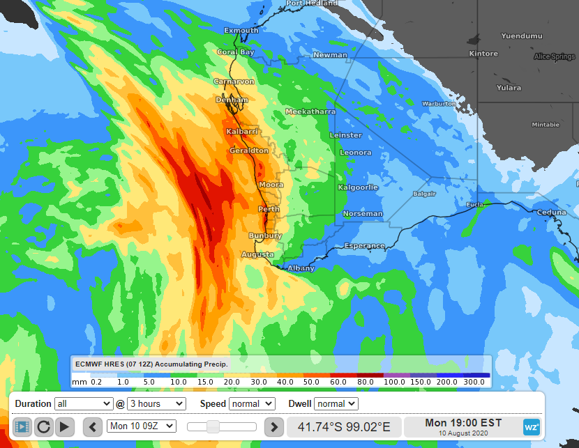
Image: Rainfall forecast to accumulate by 5pm AWST on Monday, according to the ECMWF Friday 12z run.
Furthermore, gusty winds will make it feel many degrees colder than the actual temperature over the next few days. Models suggest that winds will be most significant on Sunday, when some coastal locations are likely to experience gusts above 90km/h; even further inland, wind gusts above 80km/h are possible.
Areas of cloud, shower activity and blustery winds will persist through till the middle of next week for the state's southwest, which will keep daytime temperatures around 1-4 degrees below average.