
Two dangerous weather systems in one satellite picture
Two strong cold fronts that will cause severe weather in Australia over the coming days can be seen clearly from space.
The satellite image below was captured by the Hiwawari-8 satellite shortly after 11am AEST on Friday. It shows two significant features that will impact Australia, which are highlighted by green circles.
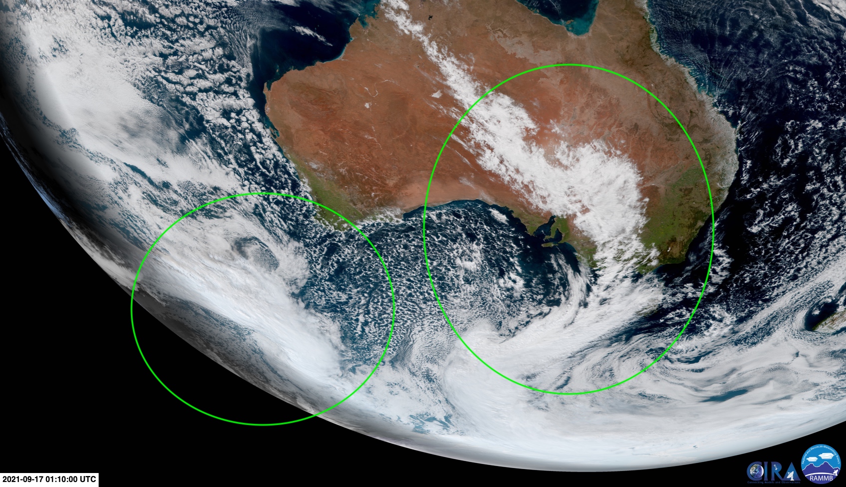
Image: Satellite image captured by the Himawari-8 satellite at 11:10am AEST on Friday, September 17. The image has been annotated with green circles to highlight two cold fronts and a north west cloud band. Source: RAMMB/CIRA
The first is a band of cloud stretching across the country from the northwest to southeast. Meteorologists call this a 'northwest cloud band' because of its orientation over Australia.
This northwest cloud band is being caused by a river of atmospheric moisture from the Indian Ocean interacting with a cold front passing over the nation's southeast. This system and will cause widespread rain over central and southeastern Australia on Friday and Saturday.
Some areas are likely to see heavy rain during the next 48 hours, especially in southern NSW, northeast Victoria and western Tasmania. The map below shows how much rain one computer model is predicting on Friday and Saturday combined.
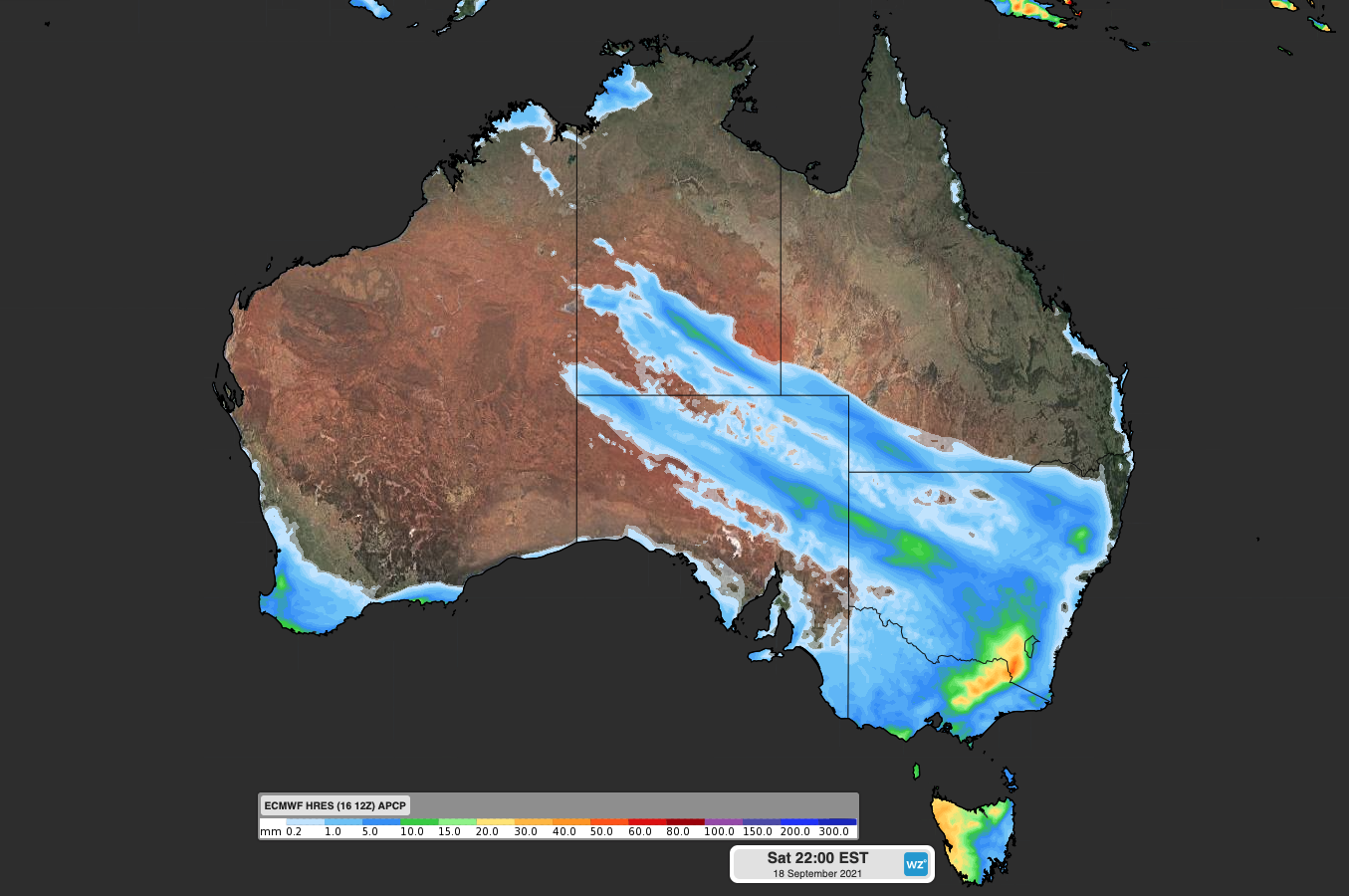
Image: Forecast accumulated rain on Friday and Saturday, according to the ECMWF-HRES model.
Damaging winds will also accompany the front on Friday into Saturday morning, with warnings in place for parts of Vitoria and southern NSW.
The other notable feature on this morning's satellite image is a mass of cloud sitting to the southwest of Australia, highlighted by a the other green circle in the image above. This region of cloud shows a second strong cold front that is on track to sweep over southeastern Australia on Sunday and Monday.
This system is going to be more powerful than the first front and is likely to cause more widespread damaging winds. It will also drag a very cold mass of air up from the southern ocean, resulting in a wintry mix of showers, thunderstorms, hail and snow in several states and territories from Sunday into the start of next week.
Make sure you keep up to date with the latest warnings during the next few days if you live in southeastern Australia.