
Three tropical cyclones possible in Australian region this week
A trio of tropical cyclones could be spinning over Australian waters by the middle of this week, with at least one of these systems a good chance of becoming a severe tropical cyclone.
The Madden-Julian Oscillation (MJO) will pass through the Australian region this week, enhancing cloud and rainfall over the tropics. With this enhanced convective activity will also come an increase in the likelihood of tropical cyclone activity in Australia’s area of responsibility.
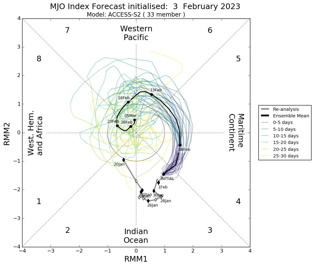
Image: Madden-Julian Oscillation (MJO) outlook, showing an active phase of the MJO passing through the Maritime Continent (area to the north of Australia) over the coming week. Each coloured line on this chart shows one individual model member’s forecast for the MJO over the coming month. The black line shows the average of all model members, which is the most likely forecast. The grey line shows the state of the MJO over the past month. When the MJO is active (outside the circle) and in phases 4, 5 or 6, we usually see more cloud and rain near northern Australia and an increased likelihood of tropical cyclone activity. Source: Bureau of Meteorology.
Several forecast models are showing signs that three tropical lows or tropical cyclones could be active in Australia’s area of responsibility by the middle of this week. We can already see the areas of cloud that may become these cyclones on the satellite image below, which was captured by the Himawari-9 satellite at 11:00am AEDT today.
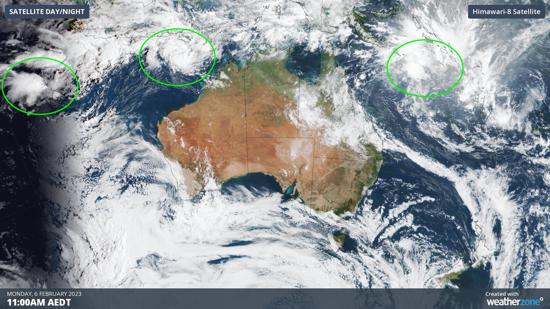
Image: Visible ‘true-colour’ satellite image showing three areas of cloud (circled green) that may become tropical lows or tropical cyclones this week.
The Bureau of Meteorology has already started issuing track maps for the western-most low, which was located near the Cocos (Keeling) Islands on Monday morning. At this stage, this low is expected to become a category one tropical cyclone on Wednesday before moving towards the west, away from the Australian mainland later in the week.
Another developing low located about 700 km to the north-northwest of Broome is expected to gain strength over the next couple of days as it drifts towards the south or southwest. This system could become a tropical cyclone by Wednesday and has the potential to strengthen further on Thursday and Friday. Forecast models currently expect this system to track towards the west and remain well to the north of WA’s Pilbara coast throughout the week.
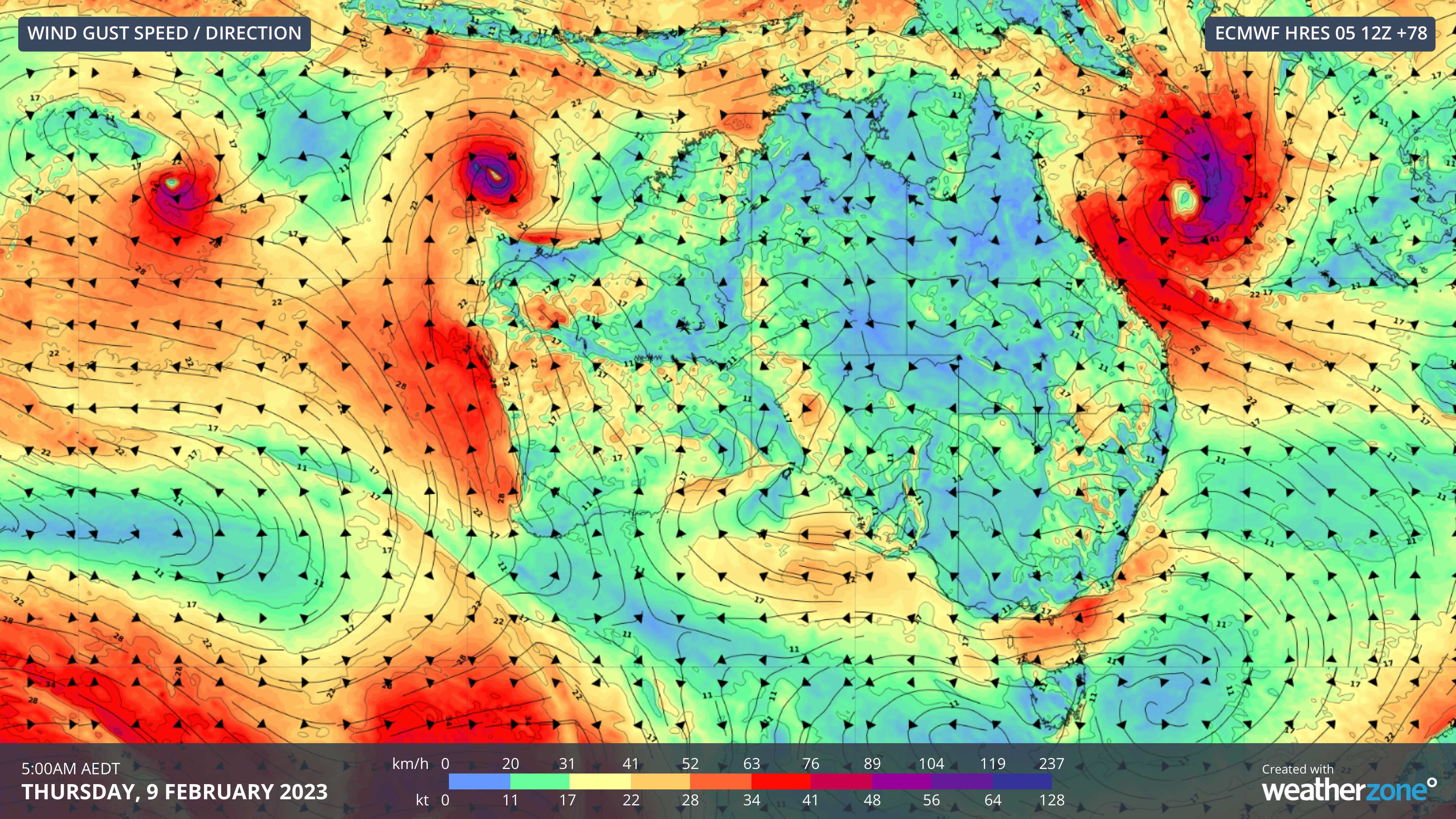
Image: Forecast wind gusts speed and direction on Thursday morning this week, according to the ECMWF-HRES model, showing three tropical lows or tropical cyclones spinning over the Australian region.
A third tropical low is expected to develop over the northern Coral Sea early this week, before gaining strength and moving towards the southwest on Tuesday and Wednesday. This system has a high chance of becoming a tropical cyclone and while it is currently expected to remain offshore all week, it may get close enough to the Queensland coast to cause dangerous weather over land. Some forecast models predict this system will become a severe tropical cyclone (category three or higher) from Thursday.
The next three tropical cyclones to form over Australia’s area of responsibility will be named Freddy, Gabrielle and Herman, with the names being assigned in order of formation.
Tropical cyclones are notoriously difficult systems to predict, and their forecast track and strength can change significantly from day-to-day. Be sure to stay up to date with the latest tropical cyclone forecasts and warnings throughout this week.