
This majestic Port Phillip Bay rain squall is about as Melbourne as it gets
This was the spectacular scene over Melbourne on Wednesday morning ahead of a cold front which crossed the city early in the afternoon.
The incredible image showing low level stratus clouds and a rain squall sweeping over Port Phillip Bay towards the city was captured at Green Point, Brighton, by artist Bill Smyth, who shares his work at billsmythimages on Instagram.
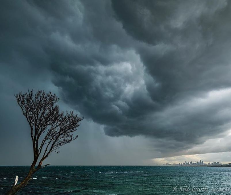
Image: Like the Melbourne Storm NRL team, this Melbourne storm image is a winner. Source: billsmythimages on Instagram.
The storm dropped temperatures briefly by a couple of degrees due to downdrafts (cold air being dragged towards the ground). Temps then rose to a maximum of 16.8°C in the afternoon, before dropping rapidly by a few degrees as the front passed through around 3 pm.
Despite the passage of yet another winter cold front and this brief storm before it, Melbourne didn't actually record much rain yesterday:
Only 0.8 mm was recorded in the 24 hours to 9 am Thursday, of which 0.4 mm fell on Wednesday morning from the storm pictured above.
Melbourne has had that sort of month. Lots of rain days, but not much in the way of total rainfall, which is actually pretty typical for July.
- So far this month, Melbourne has had 15 rain days for a total of 31.2 mm.
- The average for July is 16.1 rain days and 47.5 mm in total.
Melbourne should remain mostly dry on Thursday, with showers on and off for the next week or so.