
The green blob that paints a grey picture for the Aussie summer
Two weeks ago, the Bureau of Meteorology officially declared a La Niña event underway.
To refresh your memory, La Niña refers to a change in the sea surface temperature and wind patterns across the equatorial Pacific Ocean - the upshot of which is a greatly increased likelihood of wetter-than-usual spring and summer weather across much of Australia.
This chart says it all.
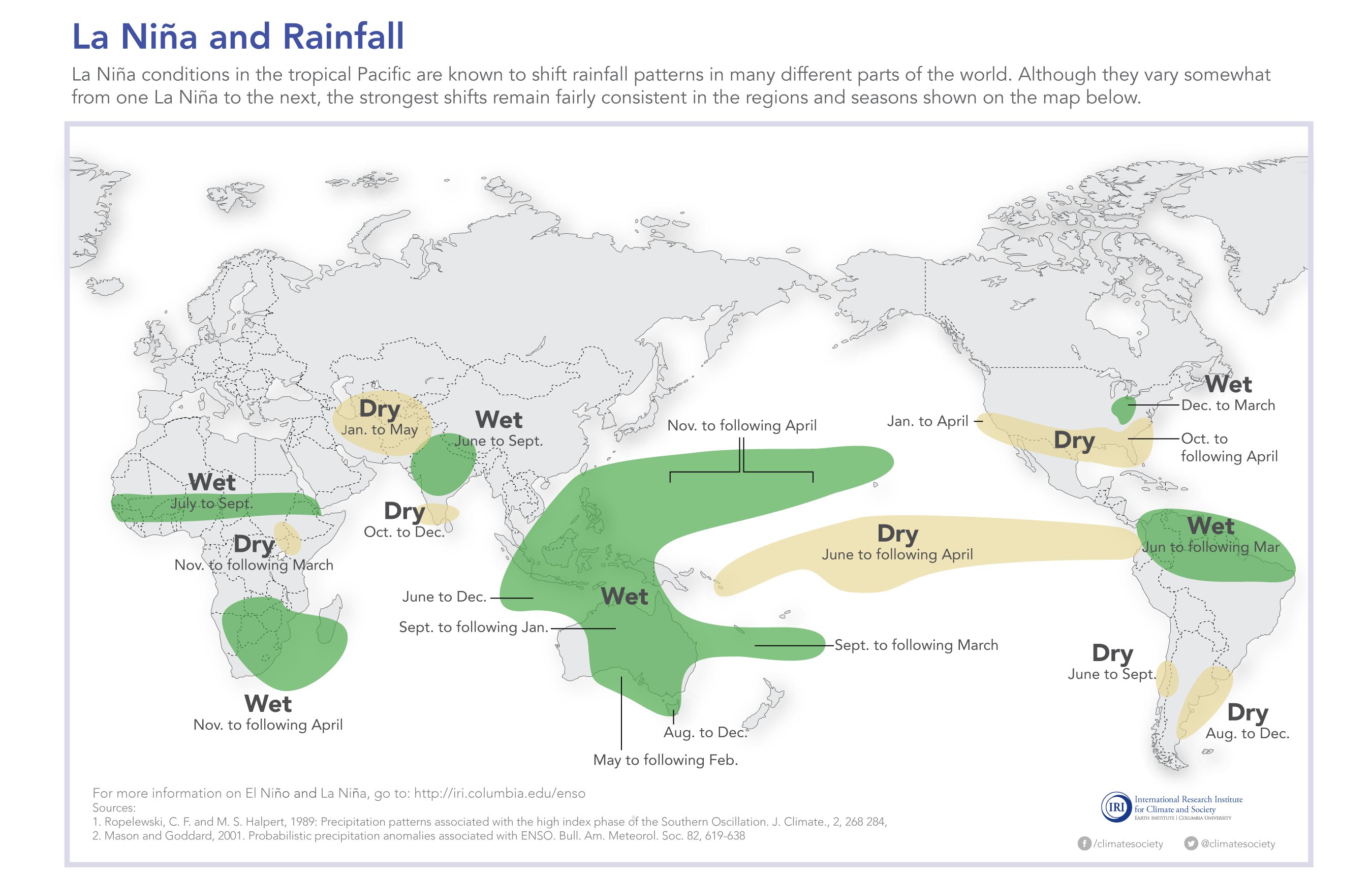
Image: Typical La Niña effects on global rainfall patterns. Source: International Research Institute for Climate and Society, Columbia University
Published by the International Research Institute for Climate and Society at Columbia University, it shows the areas which are most likely to experience increased (and decreased) rainfall due to La Niña conditions.
As you can plainly see, much of Australia - including virtually all of the east - is right in the wet zone.
The Institute points out that rainfall patterns "vary somewhat from one La Niña to the next", but the "strongest shifts remain fairly consistent in the regions and seasons shown on the map".
Our own Bureau of Meteorology paints a similar picture in its latest seasonal rainfall outlook for Australia.
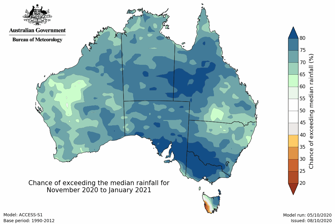
Image: The latest seasonal outlook from the BoM is tipping wetter-than-average weather across most of Australia during the next three months. Source: Bureau of Meteorology
The good news is that this year’s fire season should be less severe than last year’s for many parts of Australia. Though of course, La Niña summers can bring a range of other dangers.
As we reminded you recently, in the strong La Niña summer of 2010/11, Australia experienced numerous devastating flood events and other extreme weather which included Severe Tropical Cyclone Yasi – a destructive storm whose wind gusts were well in excess of 250 km/h.
Slightly more tropical cyclones (the usual is nine to 11) are tipped to form in the Australian region this summer, which is another side-effect of La Niña.
We can’t yet know exactly how extreme the weather will be in coming months. But the bottom line is that it might be wiser to invest in umbrella stocks than sunscreen start-ups this summer.