
Sydney's coldest day in decades
Sydney just shivered through its coldest day in 37 years as icy winds blew across NSW.
Clouds, rain and a freezing air mass wrapping around a large and slow-moving cut-off low pressure system prevented the temperature from getting any higher than 10.3ºC at Sydney's Observatory Hill weather station on Thursday, as of 5pm AEST.
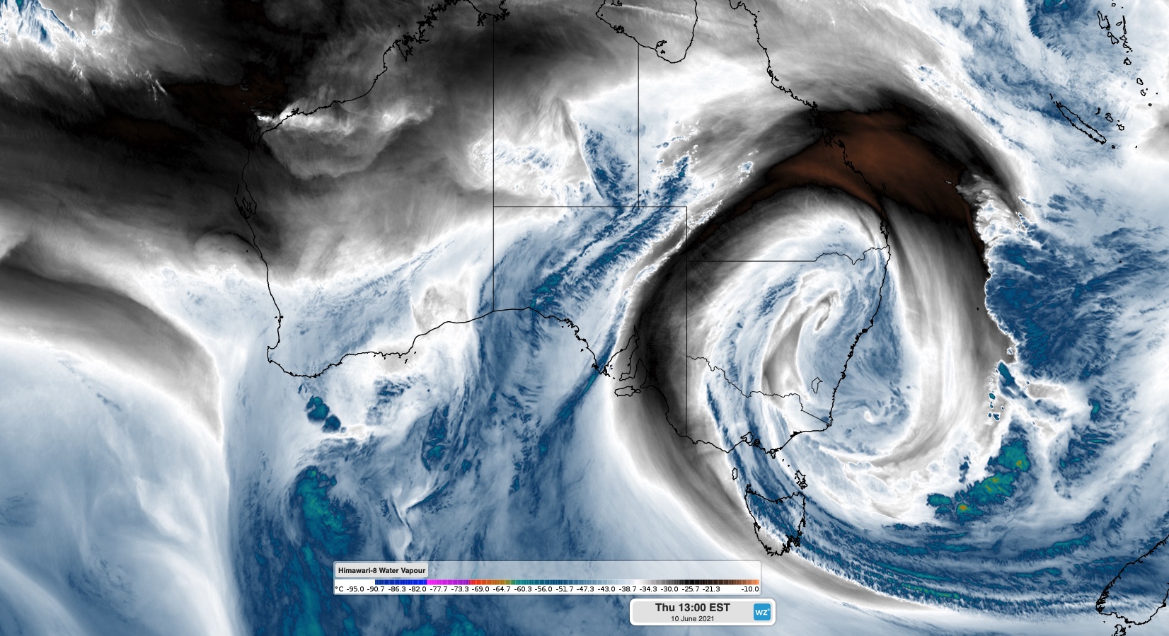
Image: Enhanced water vapour satellite image showing the upper-level cut-off low over NSW on Thursday.
If this temperature isn't exceeded by 9am on Friday, this will officially be Sydney's coldest day in 37 years.
Based on the running maximum temperatures at 5pm, it was also the coldest day in 37 years at Inverell (6.1ºC), 29 years at Mudgee (5.9ºC) and 25 years at Sydney Airport (11.4ºC).
What makes today's cold weather in Sydney even more remarkable is that it occurred under predominantly northerly winds.
Northerly winds usually drag warm air over Sydney from northern NSW or the Tasman Sea. But today, air wrapping around the large cut-off low meant that the air passing over Sydney from the north actually originated near Antarctica.
This same cut-off low also directed a stream of warmer, moisture-laden air into Victoria on Thursday. So, while Sydney was struggling to reach 10ºC under northerly winds, Melbourne spent much of the day around 14ºC in southerly winds.
The cut-off low has also brought a substantial snow to some parts of NSW during the last couple of days, while rain caused major flooding in Victoria.