
Super Typhoon Mangkhut barrels down on China

After lashing the north of the Philippines, Super Typhoon Mangkhut now has its eyes on Hong Kong, Macau and southern China.
Over northern parts of the Philippines, Super Typhoon Mangkhut produced winds in excess of 260km/h, along with flooding rains and severe storm surges.
It has now moved back over water and is recovering some of its strength.
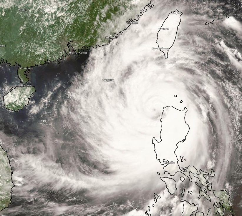
Image: Himawari-8 Satellite Visible True Colour at 2pm AEST
Super Typhoon Mangkhut is expected to continue on its West-South-Westerly track over the South China Sea and towards China over the next 24-36 hours.
Sustained winds of 210km/h, gusting to 260km/h are to be expected over the ocean, along with waves exceeding 20 metres in height (equivalent to the height of a 4-5 storey building).
Landfall is expected in the late evening on Sunday night (Australian Time) with hurricane force winds persisting over land until at least Monday afternoon. Widespread rainfall totals are likely to exceed 200mm over the event along with winds exceeding 200km/h. This area affected includes both Hong Kong and Macau but extends through much of the Guangdong province in China.
Even after it is downgraded, Mangkhut will bring heavy rain over parts of Vietnam, Laos, Thailand and Myanmar over the coming week, possibly even extending over Bangladesh and eastern India.
To see the latest warnings and forecasts of Typhoon Mangkhut visit http://www.metoc.navy.mil/jtwc/jtwc.html