
Stormy weather again for Eastern Australia next week
Another dynamic Spring system is set to roll through eastern Australia early next week, generating rain and thunderstorms, and leading to renewed river rises.
A trough moving across WA today will continue through SA tomorrow and then into VIC, NSW and QLD on Monday and Tuesday. The trough has generated a cloudband across WA but it has only produced a few showers and lightning strikes so far because of a lack of moisture. However, it will gain moisture as it tracks east, generating some thunderstorms across central Australia tomorrow before intensifying further as it reaches the eastern states – potentially bringing more severe weather to recently affected regions.
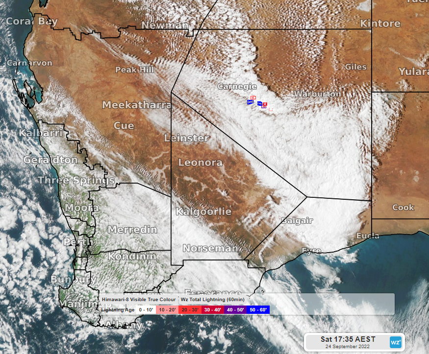
Image: Himawari-8 visible satellite image and Weatherzone lightning (squares) at 5:35pm AEST Sat 24th
When the trough reaches eastern Australia on Monday, it will deepen into a low-pressure system, and it will pull moisture not only from the north but also from the east, providing a large amount of fuel for thunderstorms and rain across QLD, NSW, and VIC. This can be seen in the following image showing a moisture quantity called precipitable water (a measure of the amount of moisture throughout the depth of the entire atmosphere), where blue and purple indicate moist air and brown and black indicate dry air.
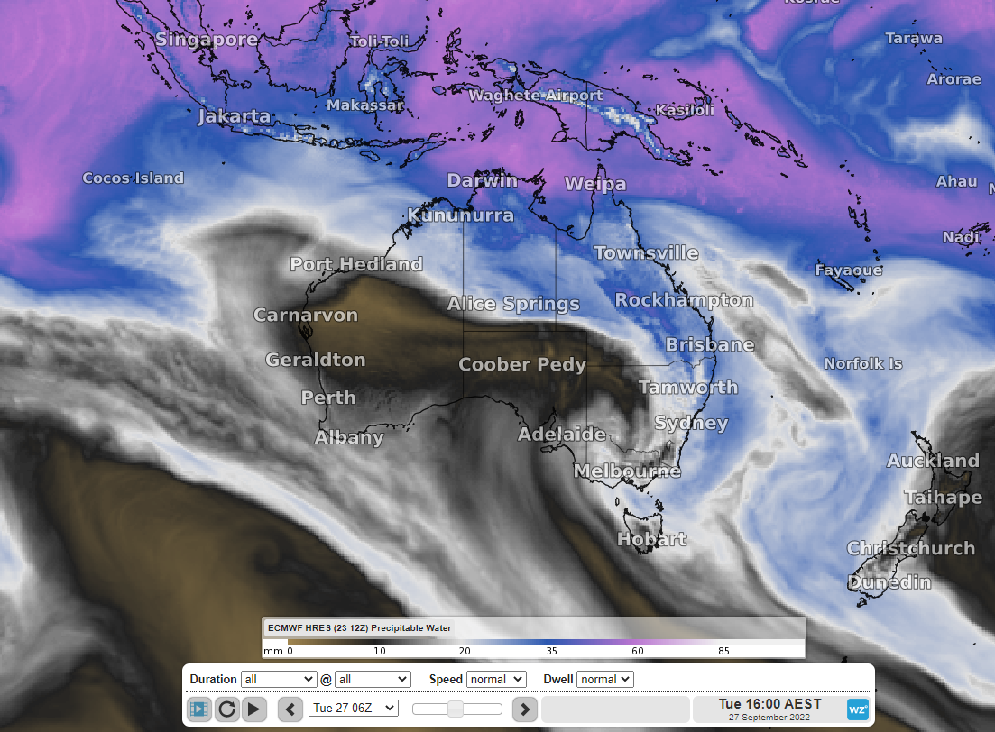
Image: Precipitable water at 4pm AEST Tuesday 27th (ECMWF model)
Thunderstorms should be most widespread on Tuesday afternoon, extending through parts of central and southern inland QLD, central and eastern NSW, and into northern VIC. Some storms may become severe through QLD and NSW, potentially causing damaging wind gusts, locally heavy rainfall, and large hail. Rain and storms could continue over eastern QLD, NSW, and VIC on Wednesday and clear on Thursday.
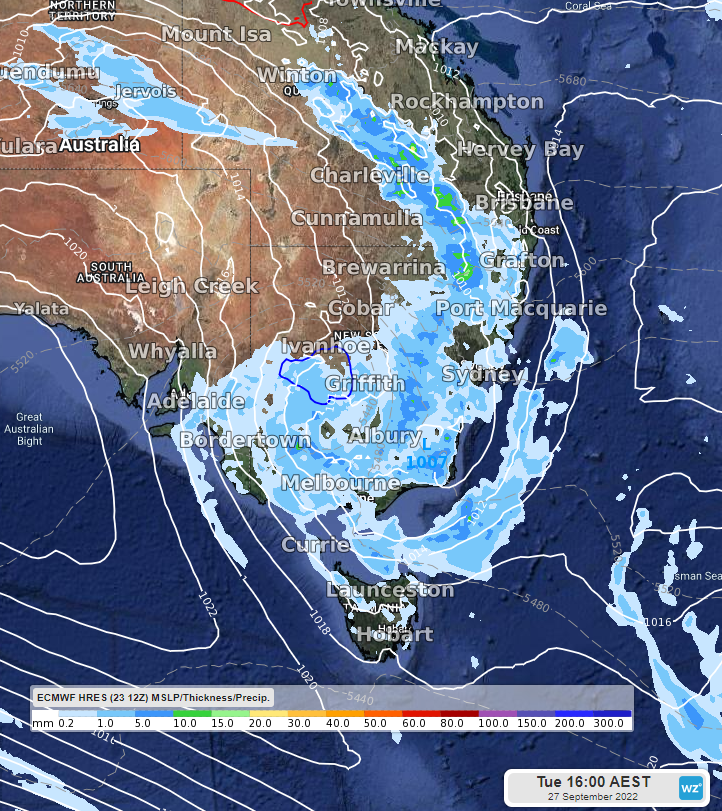
Image: MSLP and 3-hourly precipitation at 4pm AEST Tuesday 27th (ECMWF model)
Rainfall totals in the 24 hours to Tuesday evening look to be widespread 5-20mm across parts of QLD, NSW, and VIC with some places likely to see more with thunderstorms and heavy showers. Rainfall totals from now until the end of Wednesday look to be widespread 10-40mm, but with some isolated totals up to 100mm possible. This will likely lead to renewed river rises across areas that were impacted this past week by rain and storms.
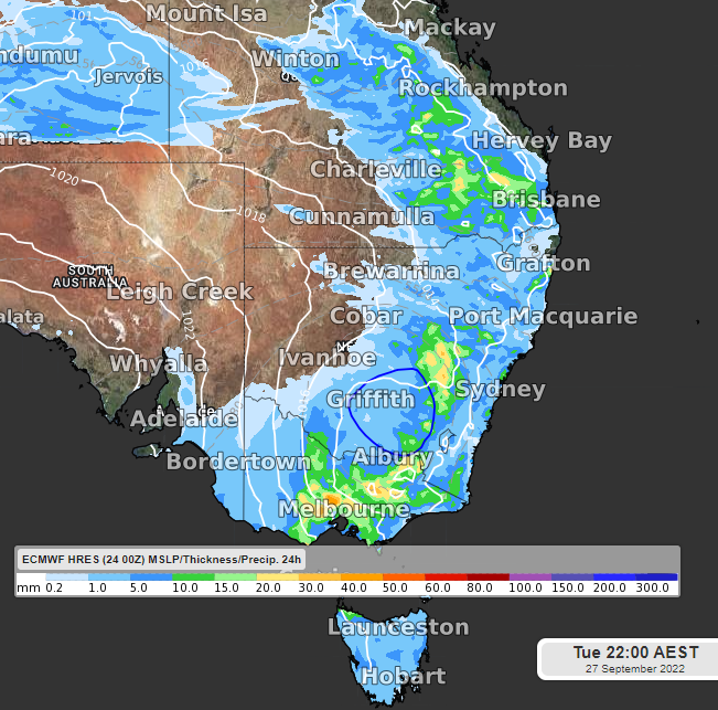
Image: MSLP and 24-hour precipitation to 10 pm AEST Tuesday 27th (ECMWF model)
Be sure to stay up to date with the latest warnings during the week at: