
Spring wind and warmth to raise fire danger in several states
A burst of hot and windy weather will cause a spike in fire danger ratings across parts of southern and eastern Australia later this week.
Northerly winds ahead of an approaching cold front will transport hot and dry air across parts of South Australia, Victoria, NSW, the ACT and Queensland between Thursday and Saturday. This heat will be followed a blustery and largely dry wind change, creating the ideal conditions for problematic fires.
The combination of hot, dry and windy weather will cause very high to severe fire danger ratings in parts of all five states and territories between Thursday and Saturday, with some areas likely to experience their hottest weather since early autumn.
On Thursday, strong winds and hot air will pass over South Australia, Victoria and western NSW. Adelaide (36C) and Melbourne (33C) are both forecast to have their hottest day in seven months, while temperatures should exceed 40 degrees in parts of South Australia.
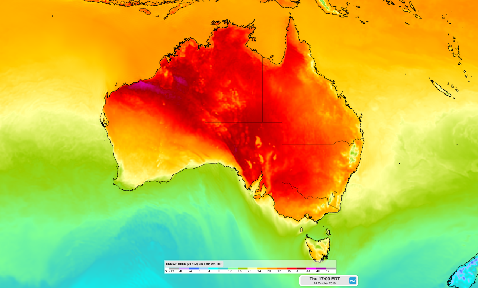
Image: Forecast surface air temperature on Thursday afternoon.
Severe fire danger ratings have been forecast in seven districts across South Australia and northwest Victoria on Thursday, with fire bans in place for some areas. Parts of South Australia could see extreme fire danger ratings on Thursday.
Isolated showers, a few thunderstorms and cooler air will spread over South Australia during Thursday afternoon and night with the passage of a cold front and an associated trough. This change will cause issues for firefighters, with a brisk shift in wind direction and the potential for thunderstorms with little or no rain.
On Friday, the hot air will shift east causing temperatures and fire danger to spike in NSW and Queensland. Parts of central, northern and western NSW are forecast to reach 35-38 degrees, including western Sydney, while the mercury could nudge 40 degrees in far western Queensland.
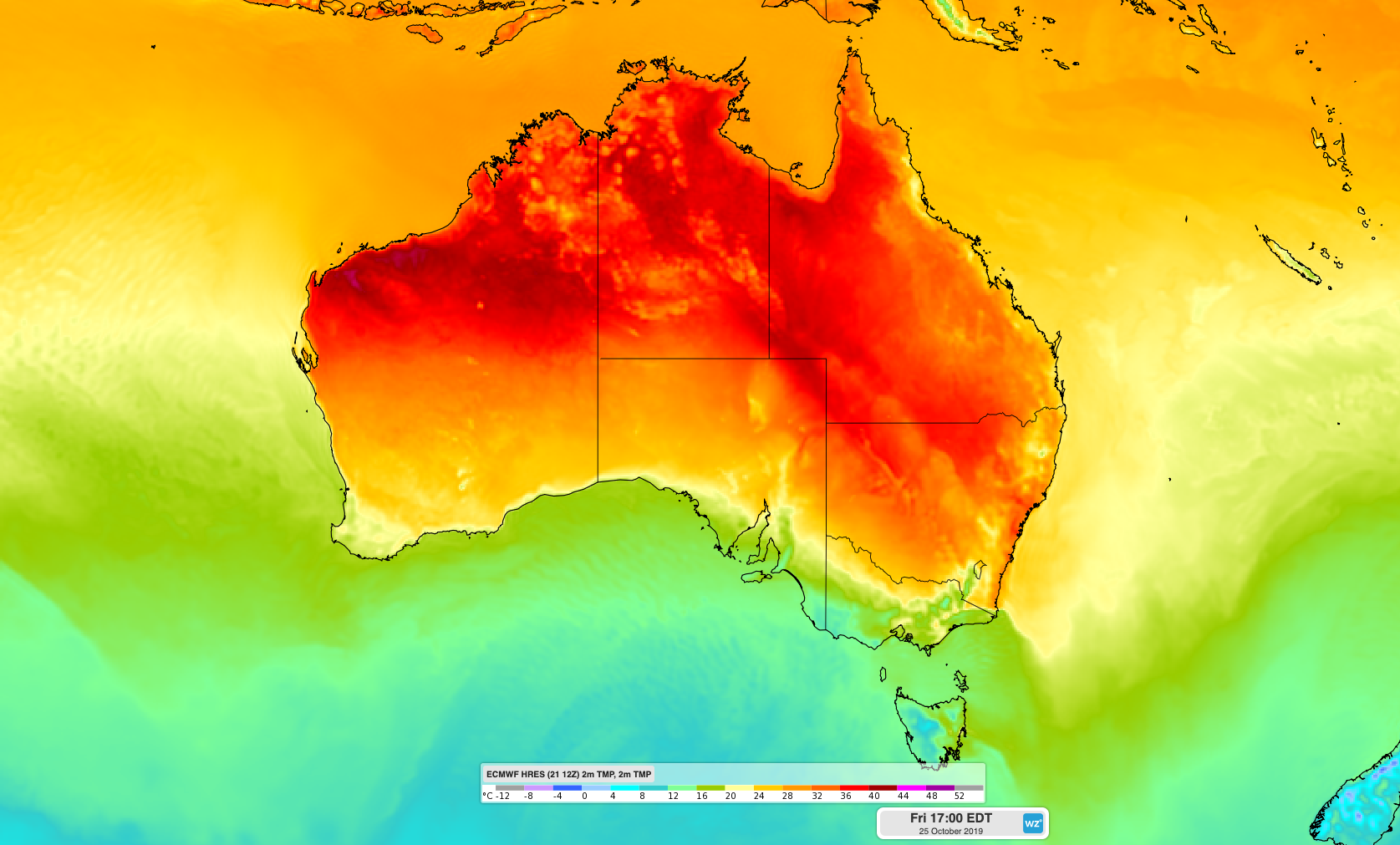
Image: Forecast surface air temperature on Friday afternoon.
Fire danger ratings will reach the very high category in parts of Queensland and a large area of NSW on Friday, likely hitting severe in some areas.
The tongue of hot air will contract further north and east on Saturday as cooler air spreads over southeastern Australia. This should lead to elevated fire danger ratings in parts of northeast NSW and southeast and central Queensland on Saturday.
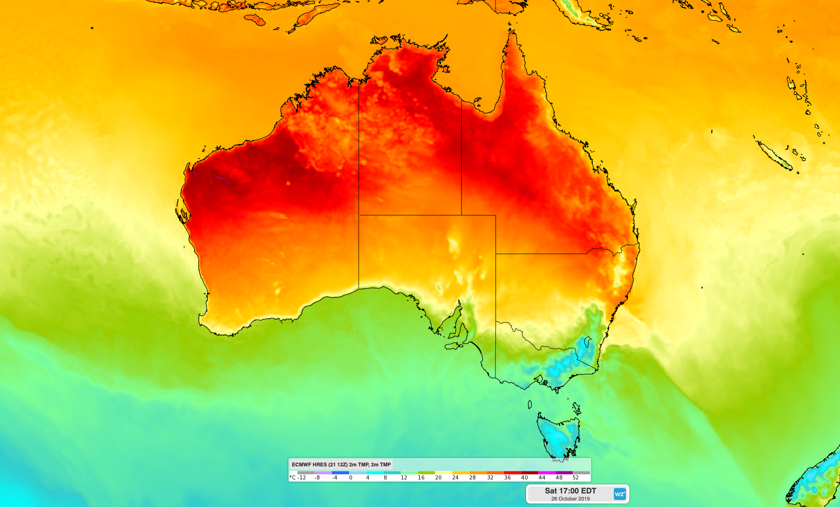
Image: Forecast surface air temperature on Saturday afternoon.
Be sure to check the latest forecasts, warnings and fire advisories during the rest of this week.