
Satellite images show snowier ground in Australia's alps
A welcome bout of snow at the end of last week has helped expand Australia's alpine snow cover, which has been slow to build up this season.
A lack of strong cold fronts during the last several weeks has limited snow accumulation in the alps.
At the beginning of last week, there was just over 20cm of snow on the ground at Spencers Creek in NSW. This is less than half the long-term average depth for that time of year.
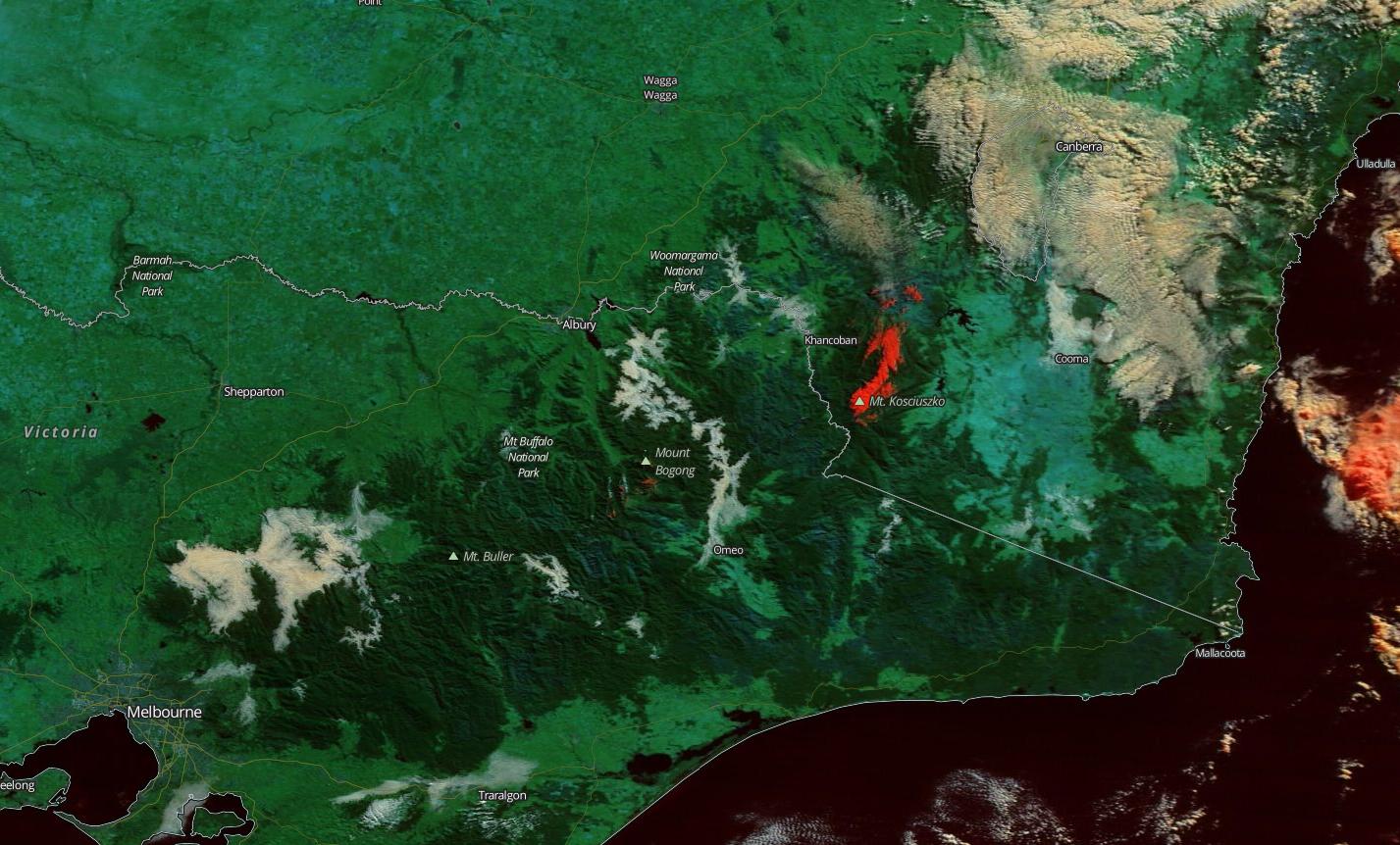
Image: False-colour satellite image showing snow cover in red on 29th June, 2020. Source: NASA Worldview
Fortunately, a series of cold fronts delivered some much needed snow to the mountains late last week, between Thursday and Saturday.
On Sunday, satellite images revealed that the spatial coverage of snow in the alps had grown substantially compared to the beginning of the week.
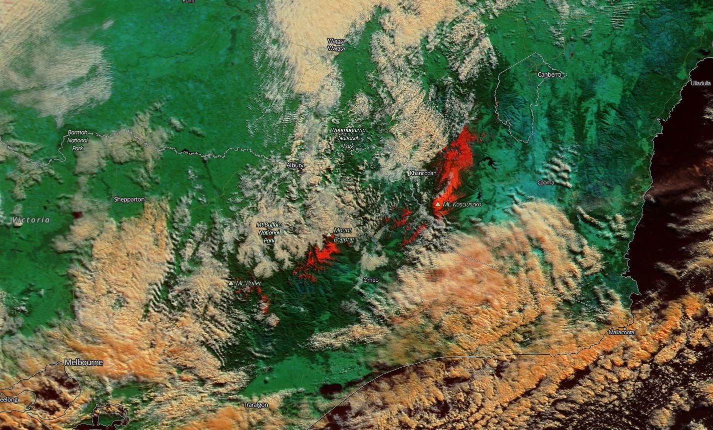
Image: False-colour satellite image showing snow cover in red on 5th July, 2020. Source: NASA Worldview
The snow was also looking good from the ground as ski resorts did their best to get the season underway amid the ongoing COVID-19 restrictions.
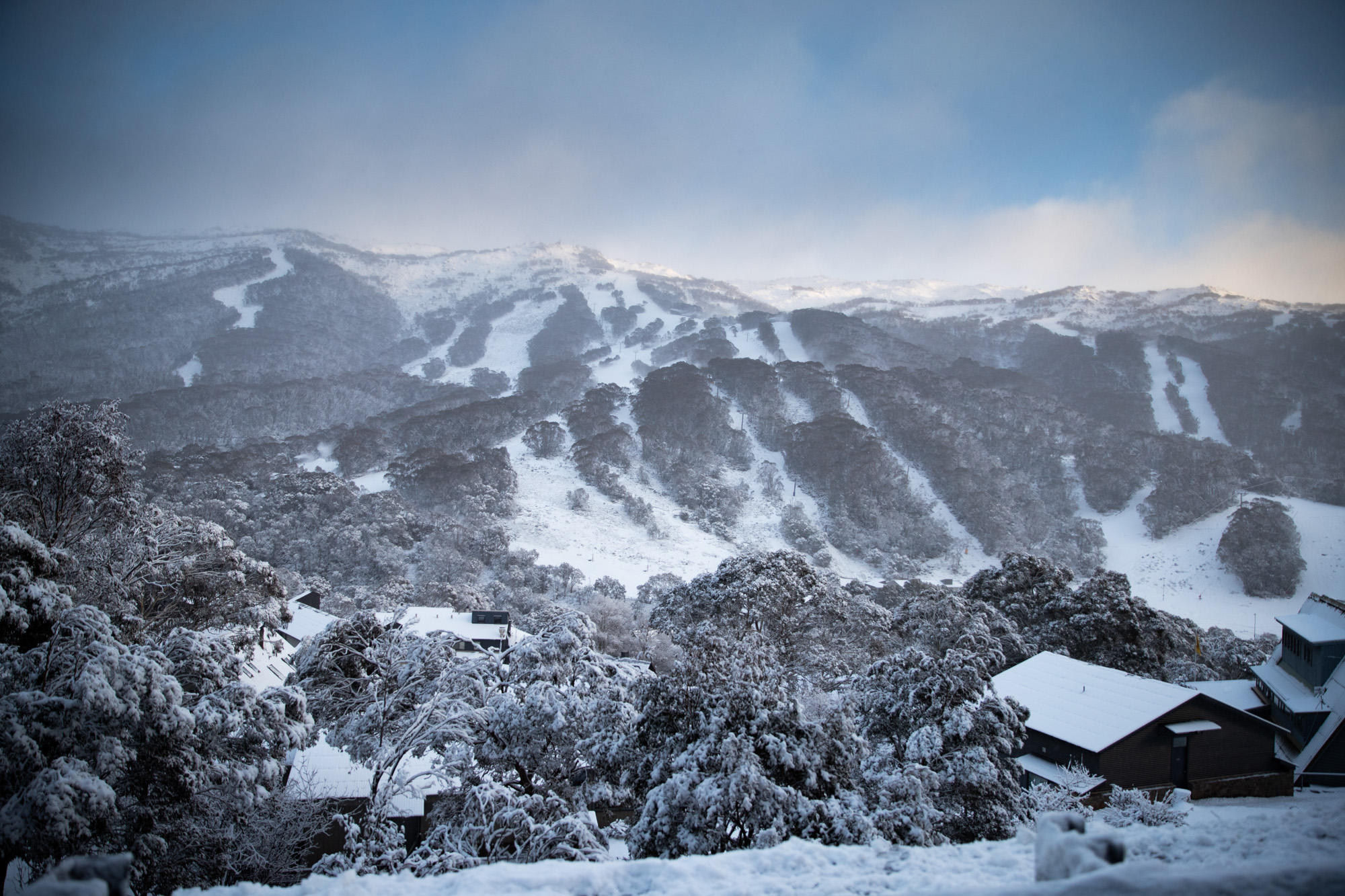
Image: Snow at Thredbo Resort on Saturday morning. Source: Thredbo
Australia's natural snow depth typically increases during July and into August amid the coldest weather of the year.