
Rainy days ahead for southeastern Australia
Rain and thunderstorms will spread across southeastern Australia during the next four days, before some of the coldest weather so far this year brings a dusting of early-season snow in the alps.
A low pressure trough will cause rain and thunderstorms over a broad area of central and southeastern Australia between Wednesday and Saturday.
Parts of northern SA, southern Queensland, NSW, Victoria and Tasmania will see 10-20mm of rain by Sunday morning. Some areas are likely to pick up more than 50mm, particularly places that get rain on multiple days or those directly affected by thunderstorms.
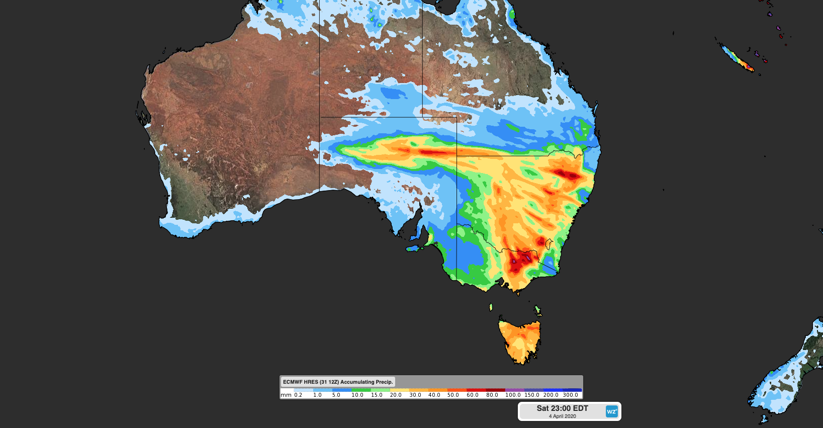
Image: Forecast accumulated rain between Wednesday and Saturday according to the ECMWF-HRES model.
This system will also produce severe thunderstorms, so be sure to check the latest warnings in the coming days.
One of the main reasons we are seeing such widespread rain and storms this week is because a large pool of cold air, which originated in the Southern Ocean, is being driven across southeastern Australia. As this frigid air mass interacts with much warmer air sitting over the Australian continent, rain and thunderstorms are produced to restore equilibrium in the atmosphere.
This type of weather event is not unusual at this time of year as we transition from summer to winter. Unsurprisingly, these systems also cause big fluctuations in temperature.
While parts of southeastern Australia are experiencing relatively warm weather during the middle of this week, the mercury will dive when the cold Southern Ocean air arrives this weekend.
Adelaide and Melbourne are only forecast to reach the high teens on Saturday, while Hobart and Canberra should only reach 14-15 degrees on Sunday. In the alps, the air will be cold enough to produce a good dusting of snow this weekend. The maximum temperature at Thredbo Top Station is forecast to be zero degrees on Sunday. This would be the mountain’s coldest day so far this year.