
Rain returns to northeastern NSW
Following a bone-dry week across the northeastern quadrant of New South Wales, rain developed over the region on Friday evening courtesy of a trough.
The highest 24 hours rainfall totals to 9am today occurred in the Port Macquarie area, where 69mm and 66mm fell at the Port Macquarie Dam and Koala Street rain gauges, respectively.
Several other locations in the Mid North Coast, Upper Hunter and eastern parts of the North West Slopes and Plains reported over 20mm in the 24 hours to 9am.
Mount Seaview has so far collected 25mm today (in the 2 hours to 11am), whilst Glendower Mountain near Tamworth picked up 17mm over the same period.
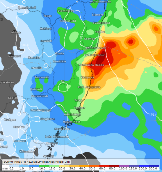
Image: Forecast rain in the 24 hours to 1pm AEST Sunday according to ECMWF, with most of this rain expected to fall on Saturday afternoon/evening
Rain continues to fall as the trough responsible slowly moves east, with a further 20-40mm expected before the end of Saturday; the heaviest rain is expected in the Mid North Coast, where further falls of over 50mm are possible.