
Rain and storms returning to eastern, southeastern Australia
After a run of relatively dry and at times showery weather in recent weeks, a more substantial outbreak of rain and thunderstorms will sweep across Australia eastern and southeastern states next week.
Forecast models are all agreeing that a low pressure trough will interact with moisture-laden air and an unstable atmosphere to produce several days of rain and storms next week.
Models also agree that parts of Queensland, NSW, the ACT, Victoria and SA and Tasmania should be affected by this system.
However, it is too early to know exactly how the rain and storms will play out just yet.
Broadly speaking, clouds and showers will start to increase over eastern and southeastern Australia on Tuesday next week. Rain and storms look to become more widespread from Wednesday and continue until at least Friday and possibly into the weekend.
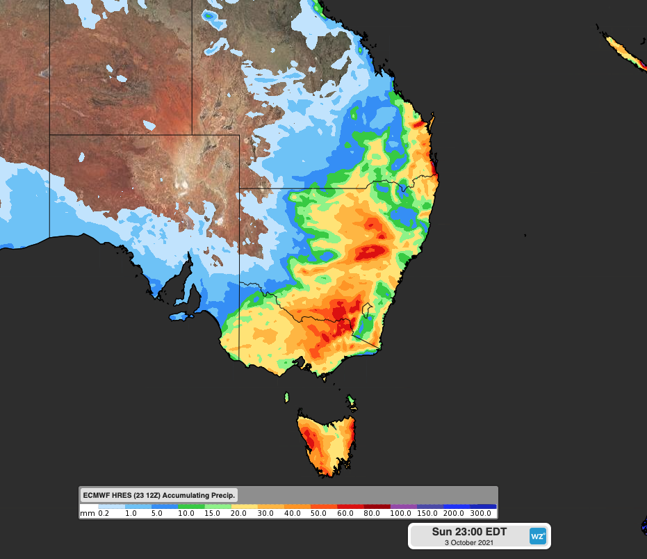
Image: Forecast accumulated rain during the next 10 days (between Friday, September 24 and Sunday, October 3) according to the ECMWF model.
Severe thunderstorms are a decent chance at this stage and could affect some states on multiple days next week. Several capital cities could also be impacted by this system.
At this stage, damaging winds look to be the most likely threat for many areas, although heavy rain, flash flooding and large hail can't be ruled out.
We will have more detailed information early next week as more reliable model data becomes available.