
Perth waiting for a visit from the Fremantle Doctor
Perth is sweltering through low intensity heatwave conditions. Today the city is set to reach the high 30s with overnight temperatures dropping only to the mid-20s, making for a restless night. This is on the back of some hot days and nights during the past week.
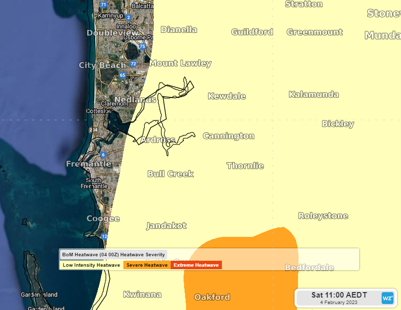
Image: Bureau of Meteorology Heatwave warning for Saturday 4 (yellow = low, orange = severe)
Despite some cloud over Perth, the thermometer was already sitting at about 30°C as of 11am AWST.
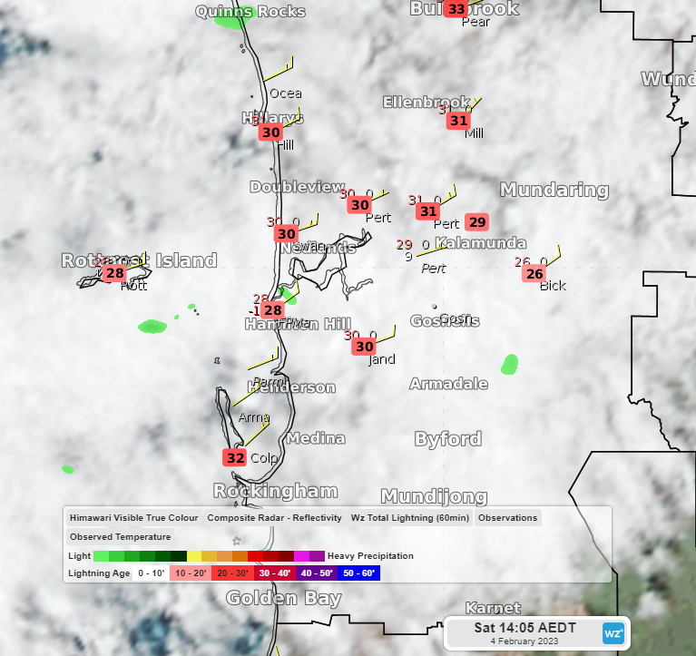
Image: Himawari 8 visible satellite imagery with temperatures at 11:05 AM AWST Saturday 4.
The driving force behind today’s heat is winds blowing from the east and northeast. These winds from the interior of WA are hot and dry. On the following forecast map for this afternoon, temperatures are shaded and wind barbs show the direction of the wind blowing from the east and northeast (think of these like arrows shot from a bow, pointing to where they are going with the feathers at the back).
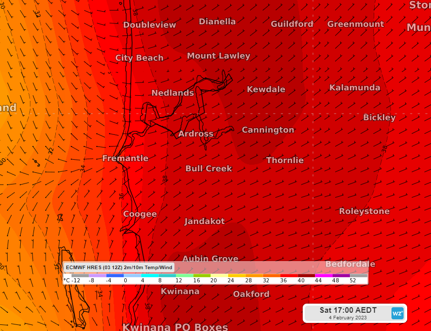
Image: Temperature and wind direction at 2pm AWST Saturday 4th according to the ECMWF model
Not only are these winds hot but they can also delay or prevent the Fremantle doctor from making a visit and cooling the city in the afternoon. Who or what is the Fremantle Doctor? It’s a name for a local wind circulation, the sea breeze, that forms on summer days when the land becomes hotter than the nearby ocean. This sea breeze comes from the southwest, passing from Fremantle and onto Perth, bringing cooler air from off the ocean. It’s just the cure for a hot afternoon!
Unfortunately, when the wind blows from the east and northeast as it is today, it can delay or weaken the formation of the sea breeze or even prevent it altogether, meaning the sweltering hot conditions continue for longer into the evening.
But the wind direction will shift in the coming days and the Fremantle doctor will be able to administer its cooling winds. The following map shows the temperature and wind direction forecast for Monday afternoon, showing the southwesterly winds bringing cooler temperatures across the city.
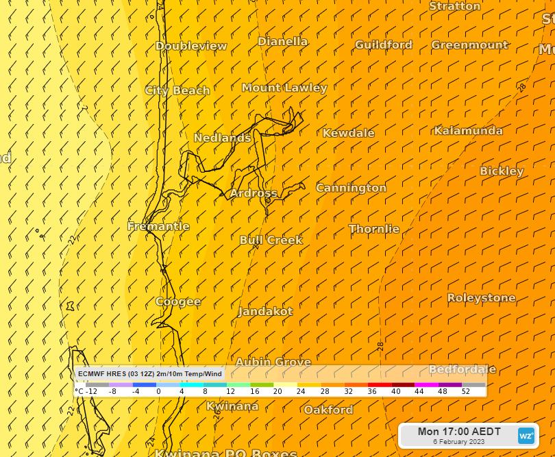
Image: Temperature and wind direction at 2pm AWST Monday 6th according to the ECMWF model
Heatwave conditions will ease for Perth from tomorrow, but severe heat wave conditions will develop across much of the interior of WA as heat pushes further inland.
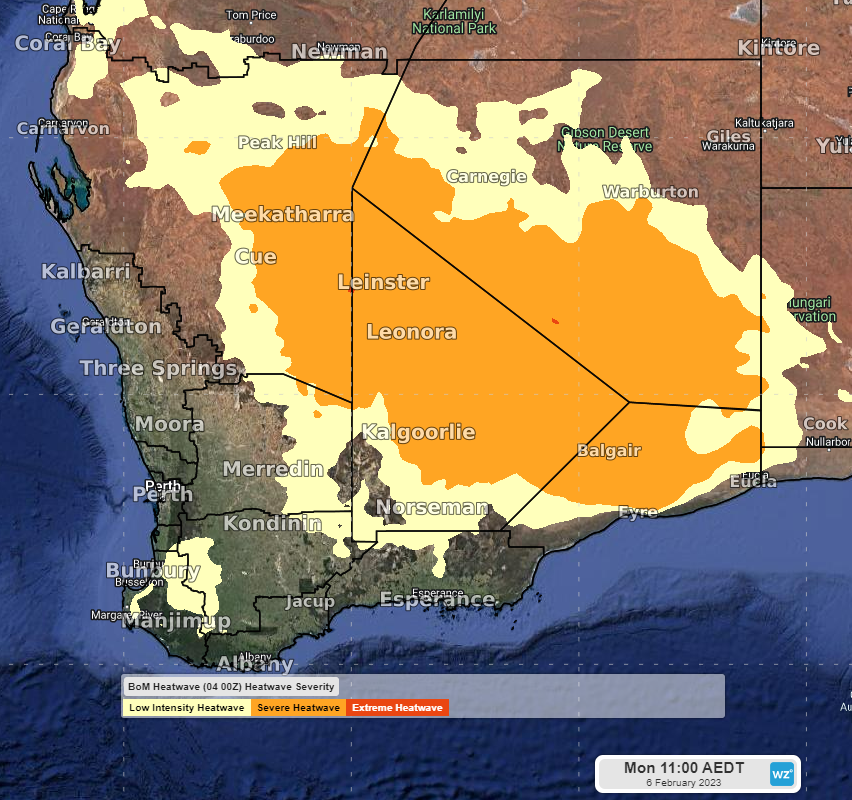
Image: Bureau of Meteorology Heatwave warning for Monday 6th (yellow = low, orange = severe).
Heatwaves can be dangerous, so please stay up to date with the latest warnings.