
Out of season run of sizeable southerly swell inbound for NSW
Activity across the Tasman Sea will bring an extended run of sizeable, and at times, large southerly swell to the NSW coastline.
Summer is typically home to long spells of small waves across southeastern Australia with blocking highs setting up across the lower Tasman Sea, preventing the generation of the predominant southerly swells that affect this part of the world. The warmer months will typically see waves from a more east-to-northeast quadrant as the trade winds and Coral Sea become more active. In winter, the reverse occurs, and coastal parts of NSW receive frequently large waves from the south-to-southeast as the Tasman fires up.
This week however, a succession of cold fronts and low pressure systems will direct an increasing amount of wave energy from this usually quiet southerly direction. Wave height is just beginning to increase across southern and central parts of NSW following the passage of a cold front overnight. Average wave height peaked around 2.8 metres in Batemans Bay this morning, while Wollongong and Sydney wave buoys are currently recording waves around 2 metres.
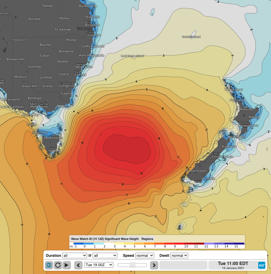
Significant wave height showing a large southerly swell reaching into the Tasman Sea with wave height exceeding 9 meters at its core on Tuesday.
The main interest of this period of southerly swell will come on Tuesday and Wednesday as waves reach into the 3 metre range. A impressively broad area of south-to-southwesterly winds extending from just above Antarctica, and blowing all the way into the Tasman Sea will lead to large surf across beaches exposed to the south. The surf could reach upwards of 6 foot, while the longer swell period may bring periods of calm and inconsistency between sets, which may catch any unexpecting swimmers or surfers off guard and out of their depth. The strong southerly winds, and maximum temperatures in the low-to-mid-20s will however limit the desire to spend time at the beach and in the water over the peak of the swell.
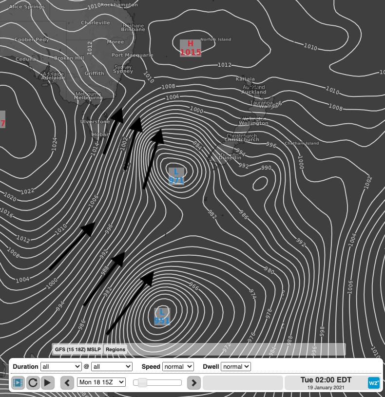
Mean Sea Level Pressure on Tuesday morning showing a succession of deep lows in the lower Tasman Sea and Southern Ocean directing a broad and extensive swath of south-to-southwesterly winds towards the NSW coastline.
However, with temperatures climbing into the high-20s on Thursday and Friday, the temptation to go to the beach and have a dip will be hard to resist. While the surf will be on the easing trend, surf conditions will likely remain treacherous and unpredictable well into Friday, bringing risk to beach goers unprepared to face larger set waves and strong rips. Regardless of this swell event, anyone considering going into the ocean should demonstrate proper beach safety this summer and properly evaluate the surf conditions, identify rips and swim in between the red and yellow flags if possible.