
More rain on the horizon for Perth

It's going to be a wet weekend in Perth, as a cold front brings a burst of wind and rain to Western Australia.
A cold front currently crossing the Indian Ocean will reach Australia's west coast on Saturday.
Blustery winds and rain will accompany the front as it moves over western and southwestern districts of WA on Saturday. This band of rain will continue to spread further north and east on Sunday, affecting parts of the Gascoyne, Goldfields and South East Coastal Districts.
Another burst of wind and showers will affect the state's southwest on Sunday, with the passage of another, smaller front.
Widespread falls of 10-20mm are likely along the state's western and southwest coasts and some western inland districts, over the weekend. Isolated falls of 30-50mm are possible, particularly with any thunderstorm activity.
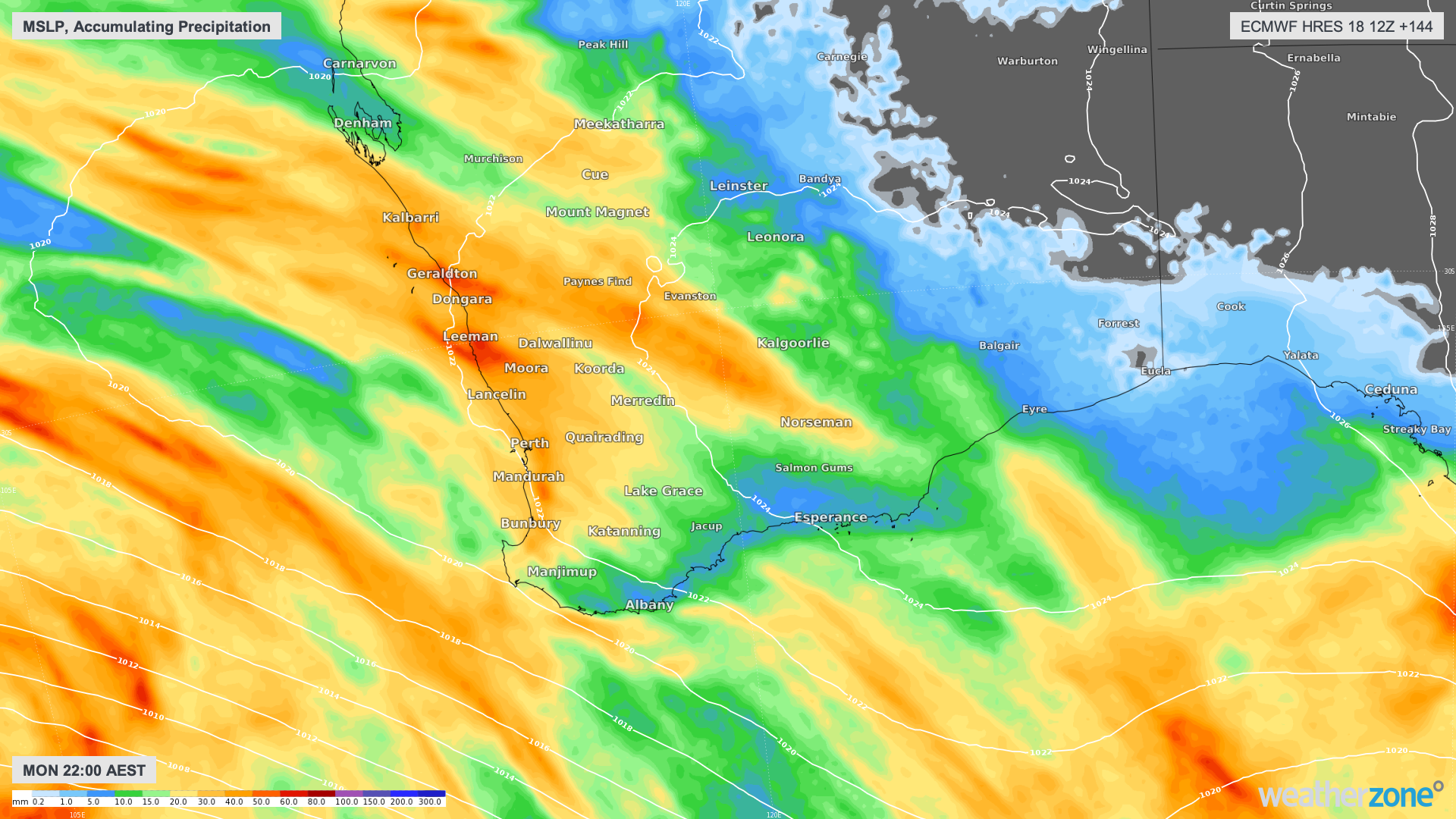
Image: Accumulated rainfall between now and Monday June 24th, according to the ECMWF-HRES model.
This weekend's rain should bump Perth's running monthly total above the long-term average for June, which is around 126mm. As of 9am on Wednesday, the city had received 119mm so far this month.
If Perth received 8mm or more over the weekend, this will be the city's wettest June in seven years. If it manages to collect 53mm or more, this will be Perth's wettest June since 2005.