
More dry, hot weather looms for NSW
Dry weather is likely to continue across much of NSW during the next week, with more heat on the way.
A low pressure trough will linger over parts of northern and eastern NSW during the rest of this week. While this system could produce daily showers and thunderstorms in northeast NSW until at least Saturday, most other parts of the state will continue to see predominantly dry weather as we head into the middle of December.
In addition to the lack of much-needed rain, temperatures are also likely to climb well above average across large areas of NSW next week as a hot air mass drifts over the state.
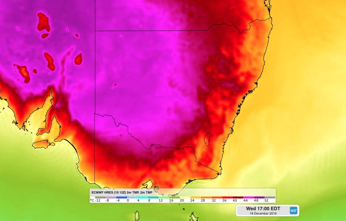
Image: Forecast surface temperature showing hot air over inland NSW on Wednesday, December 18th.
While it's too early to make accurate forecasts for the impending heat, some models suggest that temperatures could reach the mid forties over parts of western and southern NSW mid-to-late next week. There is a good chance that maximum temperatures will climb more than 10 degrees above average for this time of year in some parts of the state, possibly on multiple days.
The combination of hot and dry weather will also be problematic for the firegrounds in the eastern half of NSW next week.
On Wednesday morning, there were close to 90 fires burning across NSW, some of which had already scorched more than 300,000 hectares of bushland. Most of these fires will see little if any rain before next week's heat arrives.
The smoke from these fires will continue to drift around the coast, ranges and slopes of NSW during the next week. The movement of this thick smoke will vary from day to day as wind directions continue to shift across the firegrounds.