
Moody asperitas clouds over Mt Buller
There were strangely moody skies over the Victorian ski resort of Mt Buller on Sunday, with one of the lesser-known cloud types making a dramatic appearance.
Not too many people know about asperitas clouds, and there's a good reason for that. As the UK Met Office states, the clouds were only added to the World Meteorological Organisation's International Cloud Atlas in 2015, making them the first new cloud type in over 50 years!
"Asperitas formations are rare and resemble rippling ocean waves in the sky... These wave-like structures form on the underside of the cloud to makes it look like a rough sea surface when viewed from below," the Met Office says in its description.
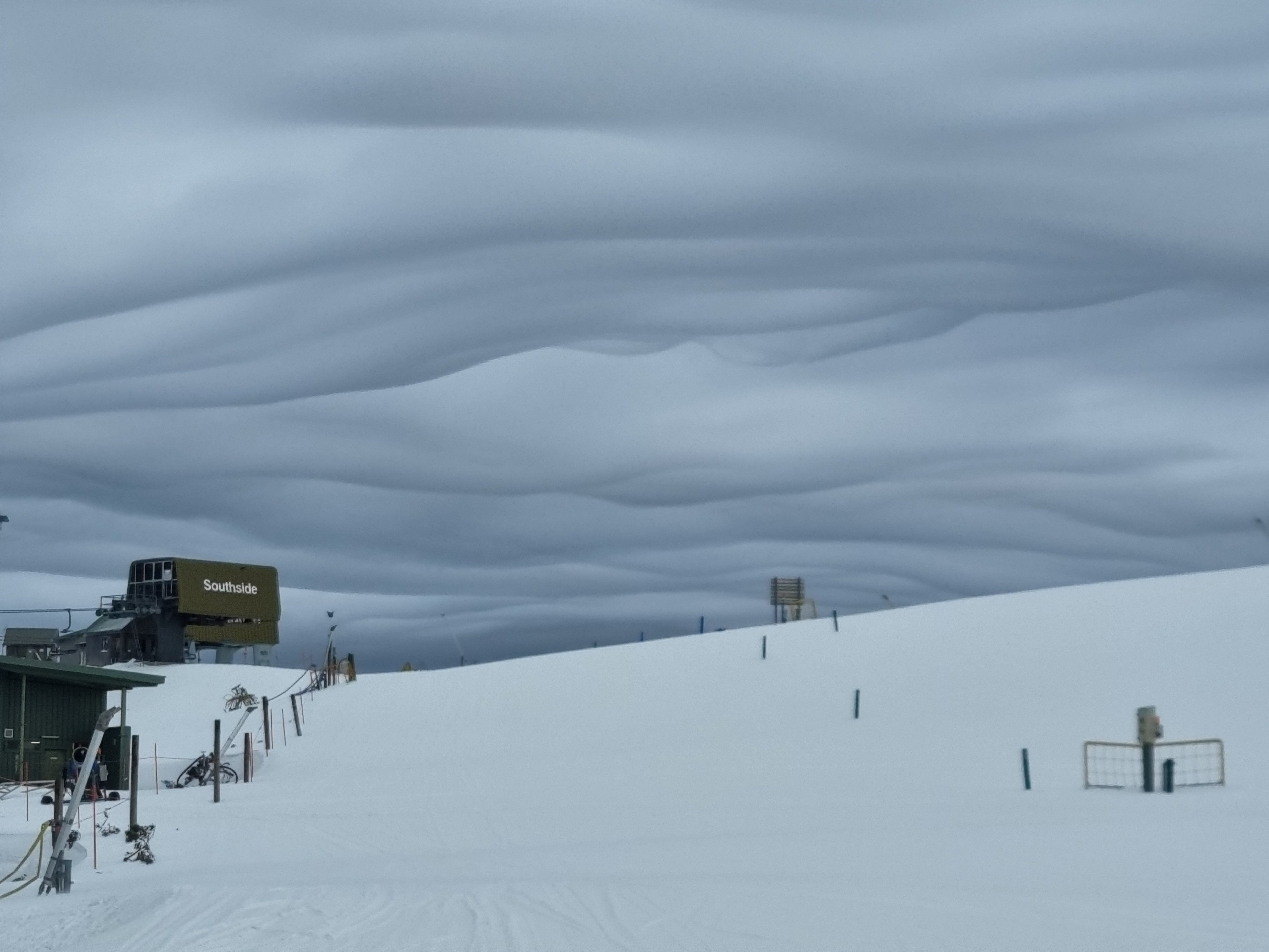
Image: Spooky! Source: blueandwhite (with permission) via ski.com.au.
The cloud name comes from the Latin word "aspero", meaning to make rough or uneven. As to why they form, that's a tricky one. According to the Met Office, there are competing theories.
- One theory is that their appearance is associated with the aftermath of convective thunderstorms, although they have also been sighted in relatively calm environments.
- Another theory suggests they form when mammatus clouds descend into areas of the sky where wind direction changes with height, causing the wave-like movement.
REMINDER: WHAT ARE MAMMATUS CLOUDS?
One thing we can say with great confidence is that the rare outbreak of asperitas clouds made for a strong Instagram game for anyone who was up at Mt Buller yesterday.
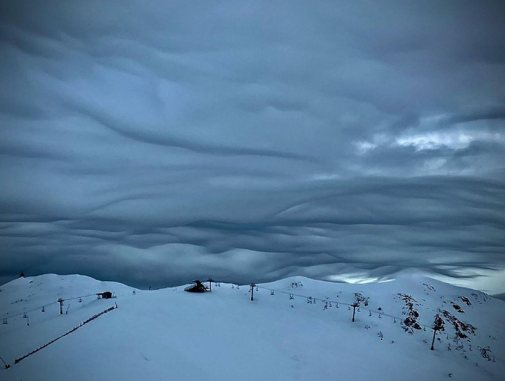
Image: Even spookier! Source: @cirque5 via Mt Buller Instagram.
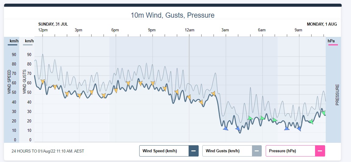
Unfortunately, it was also an extremely windy day up there on Sunday, with many ski lifts closing for safety reasons as winds gusted to 93 km/h around midday.
Some snow fell at Buller yesterday and overnight, which was good news, however an ugly week of weather is on its way, with midweek rain followed by – hopefully – enough snow late in the week to repair the damage.
From a snow lover's point of view, the skies over the next few days certainly won't be looking as enticing as they did on Sunday.