
Lows battering Australia's south and east

A pair of low pressure systems are causing severe weather along the eastern and southern coasts of Australia on Monday.
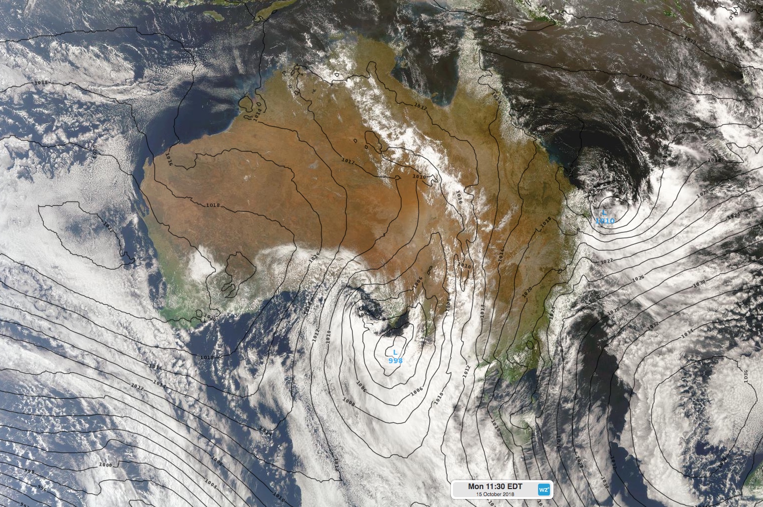
In the south, a low over the Bight and an associated cold front sweeping across South Australia are generating powerful winds, heavy showers and thunderstorms.
Severe weather warnings for damaging winds were in place for a large area of South Australia on Monday morning, due to brisk northerlies ahead of the approaching front. Thunderstorms developing near the front also bring a risk of localised damaging winds gusts. A severe thunderstorm warning was in place on Monday morning across central and eastern parts of the state.
As of 10:30am CDT, wind gusts had reached 107km/h at Mt Crawford, 83km/h in Adelaide, and 95km/h in Port Pirie. Wind will ease across South Australia in the wake of the front, although the low over the Bight will maintain fresh southwesterly winds near the coast on Tuesday.
Meanwhile, another low pressure system loitering off the nation's east coast is driving rain, wind and waves into southeast Queensland and northeast NSW.
This low has already brought more than a month's worth of rain to parts of southeast Queensland during the last few days. A rain gauge at Noosa Heads received 180mm during the 48 hours to 9am on Monday and an impressive 434mm during the last four days. As of 9am Monday, Tewantin had already received 393mm so far this month, more than half of which of which fell during the last three days. This is close to five times the site's entire October average, based on data from the last 22 years.
Severe weather warnings for dangerous surf were in place between Cape Moreton and Lennox Head on Monday, while hazardous surf warnings extended north to Fraser Island and south to the Illawarra Coast. A waverider buoy located off the coast of Coffs Harbour registered significant wave heights of 4.2m on Monday morning, with maximum wave heights getting close to 8m. The largest significant wave height measured by this buoy during October was 5.7m.
This low is expected to weaken from Tuesday, allowing wind, rain and surf to ease along the east coast. Visit http://www.weatherzone.com.au/warnings.jsp for the latest warnings.