
Late-September cold snap not seen in years
A strong cold front will hit southeastern Australia later this week, bringing rain, hail, snow, and winter-like temperatures in multiple states.
The cold air mass that's currently approaching Australia originated over waters near Antarctica. While it's not uncommon for air this cold to reach our continent during winter, it's unusual for it to happen this late in spring.
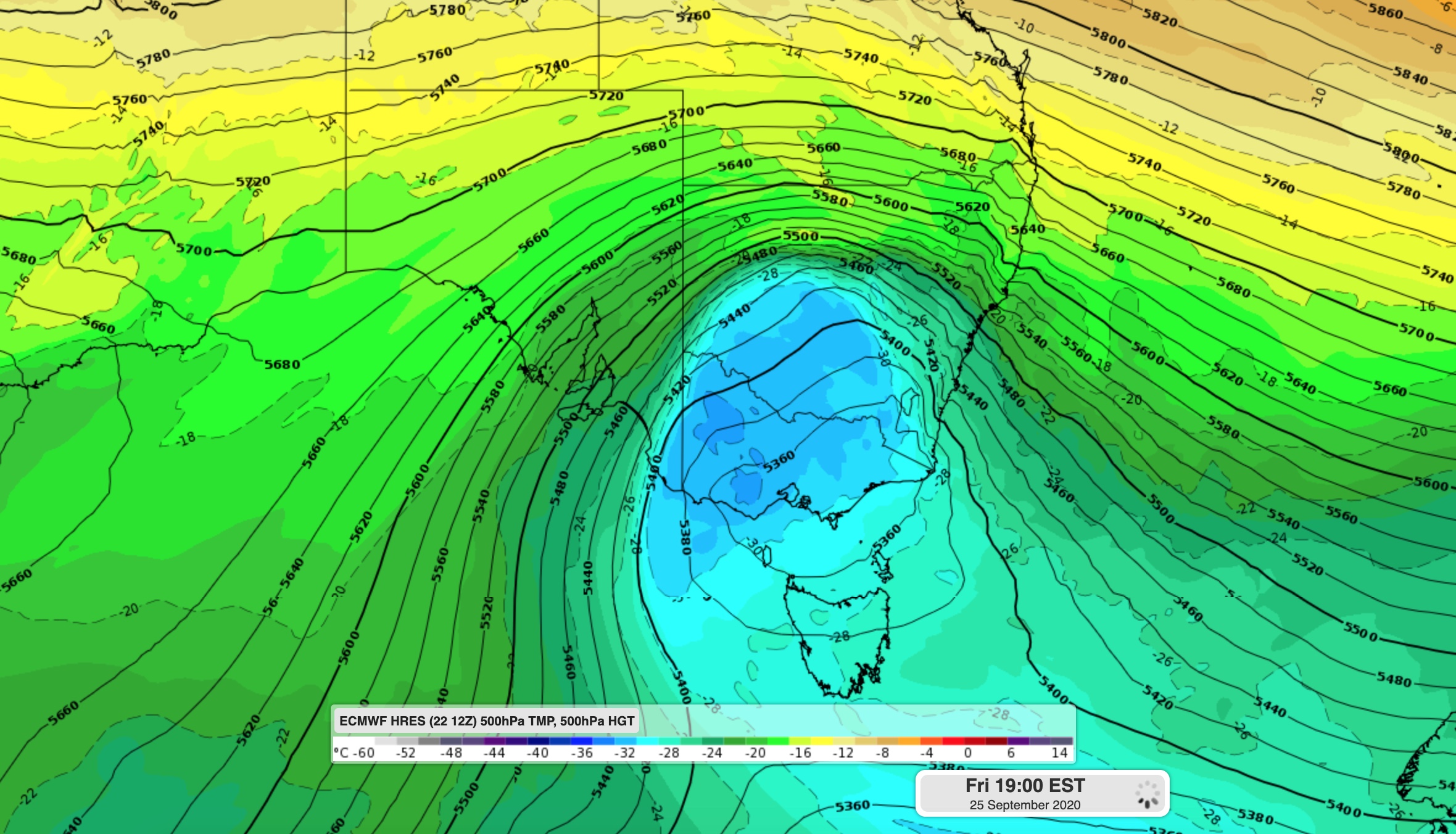
Image: Forecast model (ECMWF) showing cold air over southestern Australia on Friday.
The front at the leading edge of the cold air mass will cross southeastern Australia between Thursday and Saturday, causing showers, thunderstorms, and potentially damaging winds in parts of Tasmania, South Australia, Victoria, NSW, and the ACT.
As the cold air moves in behind the front, snow, and hail will also fall in multiple states on Friday and Saturday. Temperatures could get low enough for snow to reach around 500-600 metres elevation in parts of Tasmania and Victoria and 700-800 metres in southern and central NSW (including the ACT).
The combination of cold air, cloud, and rain could see some places experience their coldest day this late in spring in a couple of decades.
Melbourne's forecast top of 12 degrees on Friday would be the city's coldest day this late in spring since 2002. Some models suggest that it might not even get this warm during the day, possibly only reaching about 11 degrees.
Adelaide is forecast to reach 13 degrees on Friday. If it stays below 13.6 degrees, this will be the city's coldest day this late in spring since 1997.
Severe weather is likely during this event, so be sure to check the latest warnings in your area.