
Heat returning to southeastern Australia as more storms loom for eastern states
Hot and windy weather will elevate fire danger ratings in parts of southeastern Australia during the middle of this week, just days after heavy rain and severe thunderstorms brought large hail and flash flooding.
A burst of warm and gusty northwesterly winds will pass over SA, Victoria, Tasmania and NSW on Wednesday and Thursday ahead of an approaching cold front.
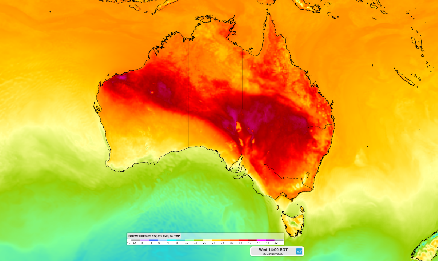
Image: Forecast surface air temperature on Wednesday afternoon, according to the ECMWF-HRES model.
On Wednesday, temperatures are forecast to reach the low thirties in Adelaide, Melbourne and Canberra and the high twenties in Hobart. Some places in South Australia's northern inland and western NSW are likely to climb above 40 degrees.
Wednesday's heat will combine with fresh to strong northwesterly winds to produce Severe to Extreme fire danger ratings in parts of Victoria and SA. Despite recent rain, these blustery winds could also cause dust storms over Australia's southeastern inland.
Following this brief burst of heat, a cool change will sweep across SA, Victoria and Tasmania, reaching Adelaide in the middle of Wednesday and Melbourne and Hobart on Wednesday evening.
Showers and thunderstorms will develop near and behind this change, some of which could become severe. Forecast models suggest that parts of central Victoria and Tasmania could pick up more than 20mm of rain between Wednesday afternoon and Thursday morning.
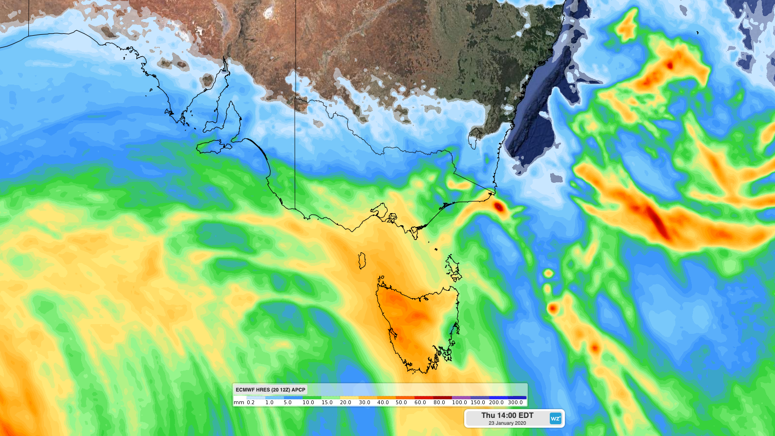
Image: Forecast accumulated rain by Thursday afternoon, according to the ECMWF-HRES model.
On Thursday, hot air will travel further north and cause temperatures to climb over parts of NSW. Very High to Severe fire danger ratings are likely across most of the state, with temperatures forecast to reach the low forties in some central and northern districts, including western Sydney.
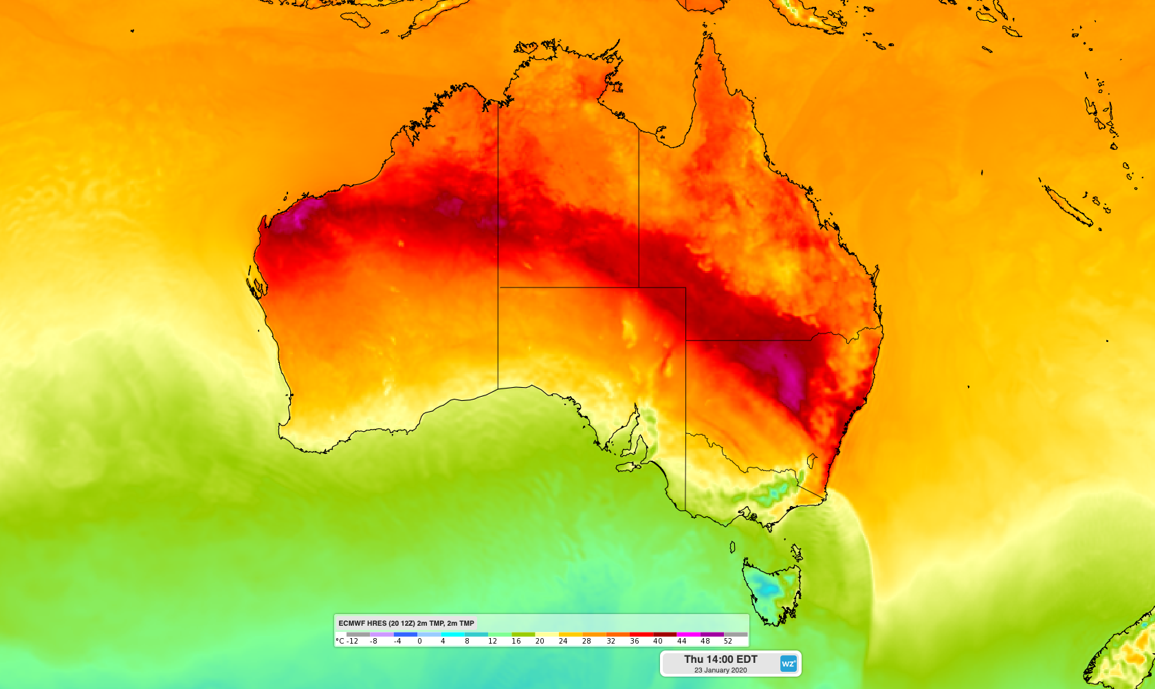
Image: Forecast surface air temperature on Thursday afternoon, according to the ECMWF-HRES model.
Warm and humid air will linger over eastern Australia during the remainder of the week, helping produce widespread showers and thunderstorms in Queensland and NSW from Friday until at least Monday. This muggy warmth will also cause a Low-Intensity to Severe heatwave in parts of NSW and Queensland during the next several days.