
Healthy overnight snowfalls greet skiers and boarders on Saturday
A cold front delivered widespread 15-25cm of fresh snow to Victorian and NSW ski resorts overnight, making for a cracking start to the weekend.
The second in a series of cold fronts started crossing the Victorian ranges on Friday afternoon, with rain tending to snow by late afternoon. The front reached the NSW Snowy Mountains later in the evening, and by the time the front cleared early Saturday, some of the best snowfalls this winter were blanketing the mountains.
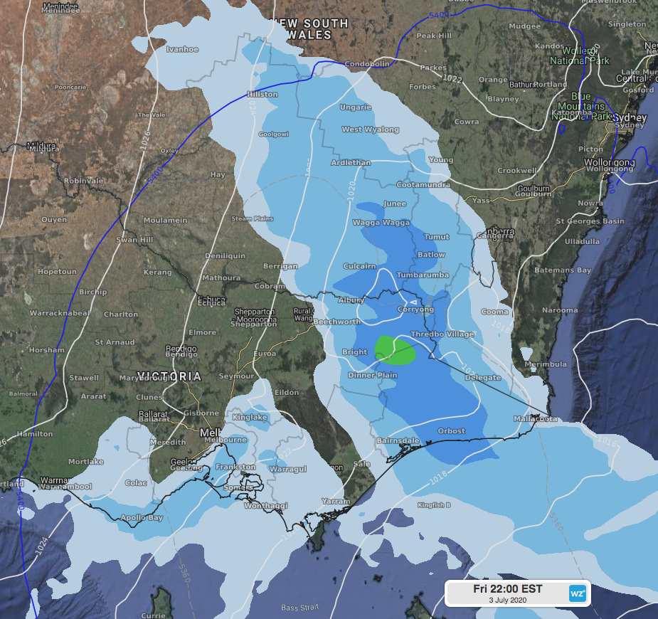 Image: ECMWF forecast precipitation for late Friday 3rd over the southern ranges. Note the blue line representing possible snow behind it at high enough elevations.
Victorian resorts fared better than those in NSW, with most resorts receiving around 20-25cm of new snow. In NSW, most resorts recorded around 15cm from the front. Snow was not just confined to the higher elevations either, with snow seen falling at Berridale, NSW, at about 860 metres elevation.
The skies have cleared over NSW resorts while lingering low cloud is hanging about some Victorian resorts on Saturday morning. Further light flurries are possible during Saturday and Sunday, however they won’t amount to much. This coming week will generally be clear and dry over the mountains before the next front due next weekend. Despite no natural snow forecast from Monday until the next front, well below freezing temperatures at night will be perfect for snow makers to top up the cover.