
Flooding rain on the horizon for southern inland Queensland

A flood watch has been issued in southern Queensland for river catchments between Thargomindah and St George, ahead of heavy rain and thunderstorms this weekend.
A near-stationary low pressure trough over inland Queensland interacting with an injection of moisture-laden air from the Coral Sea will trigger rain and thunderstorms over the state's central and southern interior this weekend.
Widespread falls of 20-40mm are likely over parts of the Central Highlands and Coalfields, Central West and Maranoa and Warrego Districts on both Saturday and Sunday. Some places could see more than 100mm per day if thunderstorms pass overhead.
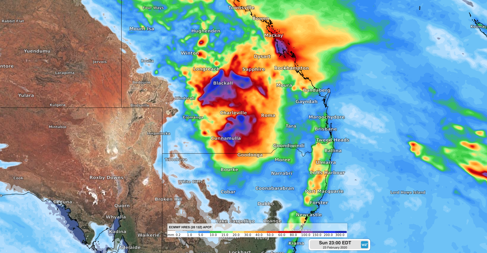
Image: Forecast accumulated rain between Friday and Sunday, according to the ECMWF-HRES model.
Some of this weekend's rain will be falling over areas that are already flooded following wet weather during the last several weeks. On Friday morning, major flooding was occurring in the Balonne River to the north of St George.
The wet landscape will make it easier for rivers to flood in response to this weekend's rain.
If you see a flooded road, the best thing to do is turn around. If it's flooded, forget it.