
Ex-Tropical Cyclone Uesi bypassing Australia, heading for New Zealand

Mainland Australia has avoided the worst weather from Ex-Tropical Cyclone Uesi, although Lord Howe Island has taken a hit and New Zealand is now in the firing line.
After passing close to New Caledonia as a category three severe tropical cyclone on Tuesday night, Tropical Cyclone Uesi travelled south and transitioned into an extratropical cyclone (also called a mid-latitude low pressure system) on Thursday morning.
After moving further south, Ex-Tropical Cyclone Uesi passed close to Lord Howe Island early on Friday morning. A weather station on the island started registering wind gusts above 100km/h on Thursday evening and clocked a gust of 154km/h shortly before 2am on Friday. The system also dumped 41mm of rain at Lord Howe Island Airport.
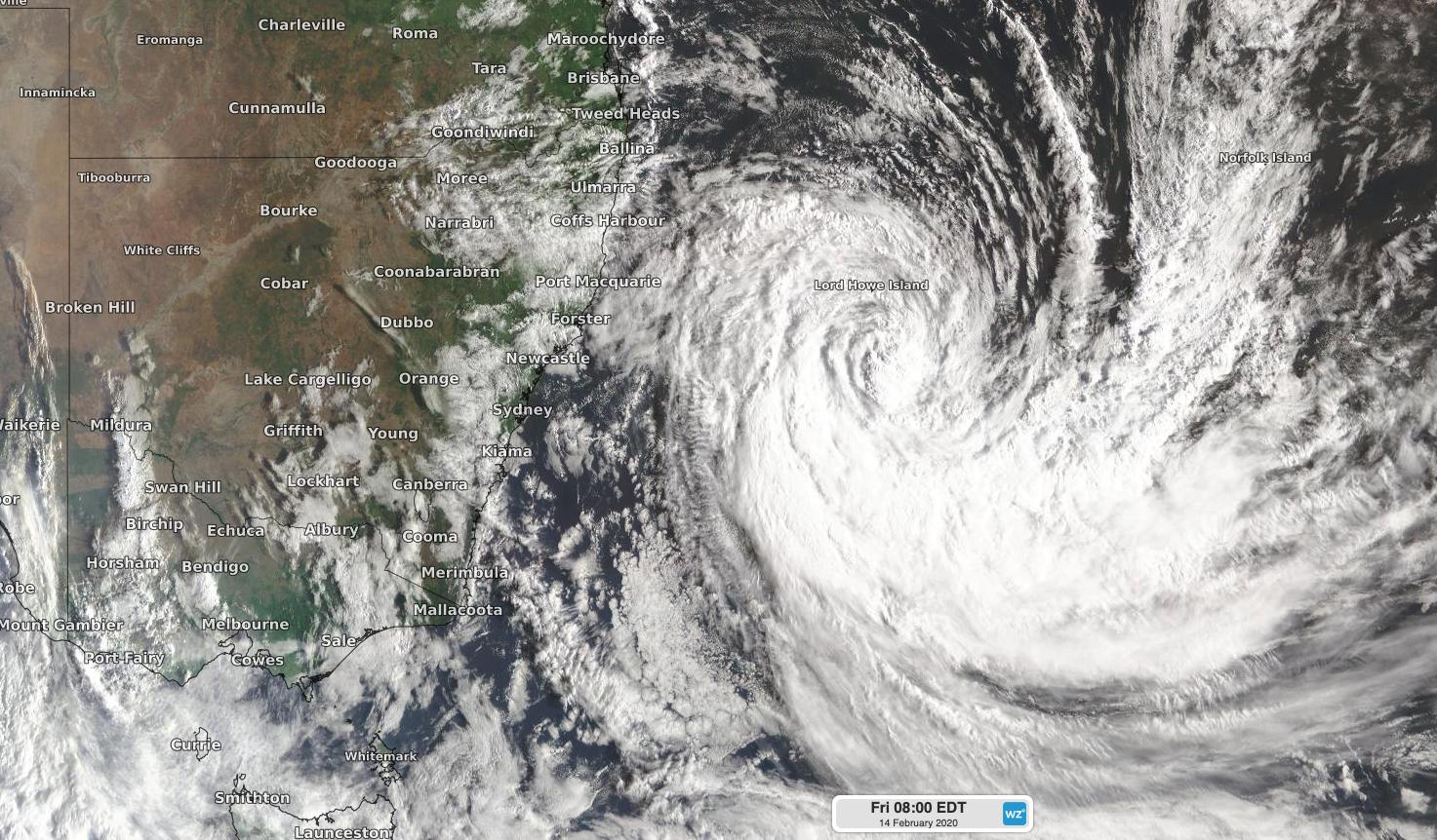
Image: Satellite image of Ex-Tropical Cyclone Uesi to the south of Lord Howe Island on Friday morning.
Looking ahead, Ex-Tropical Cyclone Uesi will move in a southeasterly direction on Friday, allowing conditions to ease on Lord Howe Island. However, the system should continue on this track into the weekend, putting it on a collision course with New Zealand.
Heavy rain and potentially damaging winds will develop over parts of New Zealand's South Island on Sunday and continue into Monday. The country's Met Service has already issued numerous watches and warnings for this system and these will be updated with more detailed information as it gets closer.

Image: Forecast 24-hour accumulated precipitation and mean sea level pressure at 11am AEDT on Sunday, according to the ECMWF-HRES model.
While mainland Australia has escaped the direct impacts from Uesi in terms of damaging wind and heavy rain, parts of the east coast are still receiving a pulse of big swell from the former tropical cyclone.
Maximum wave heights of 5-to-7 metres were recorded along Queensland's southeast coast on Thursday night and Friday morning. Further south, a buoy off the coast of Byron Bay registered a wave measuring 9.27 metres early on Friday.
This large swell will spread further down the NSW coast on Friday and Saturday and also affect far eastern Victoria and eastern Tasmania on the weekend. Hazardous surf warnings have been issued along parts of Australia's east coast in response to this swell.