Devastating deluge in the snowfields
Heavy rain, not snow, continues to fall, in the snowfields, especially in New South Wales.
This was the scene on Thursday at Perisher Valley, NSW, which is Australia's largest, second-highest and most popular ski area. Not good.
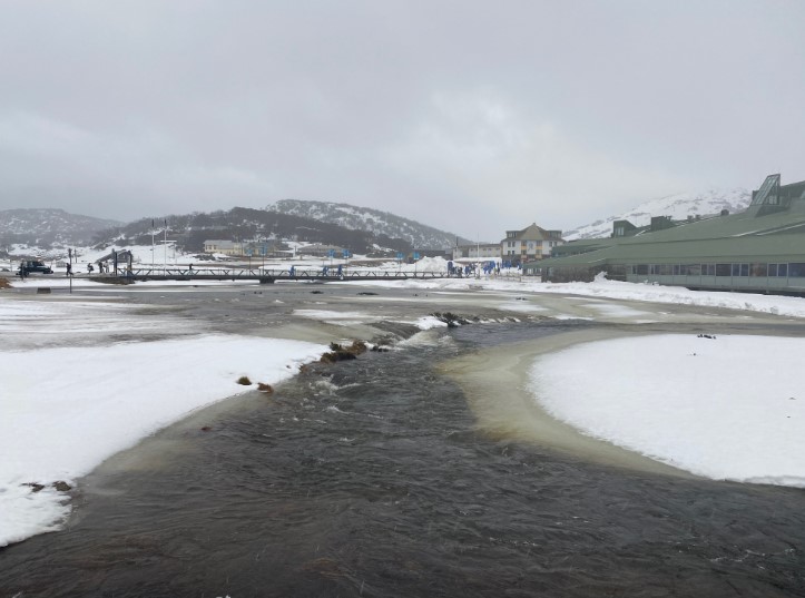
Image: Perisher Creek rapidly becoming a lake. Source: Steve Smith.
The image shows Perisher Creek spilling its banks with the Perisher Centre (the resort's main base building) to the right. The mostly treeless slopes of Mt Perisher are in the distance, rising above the Perisher Centre.
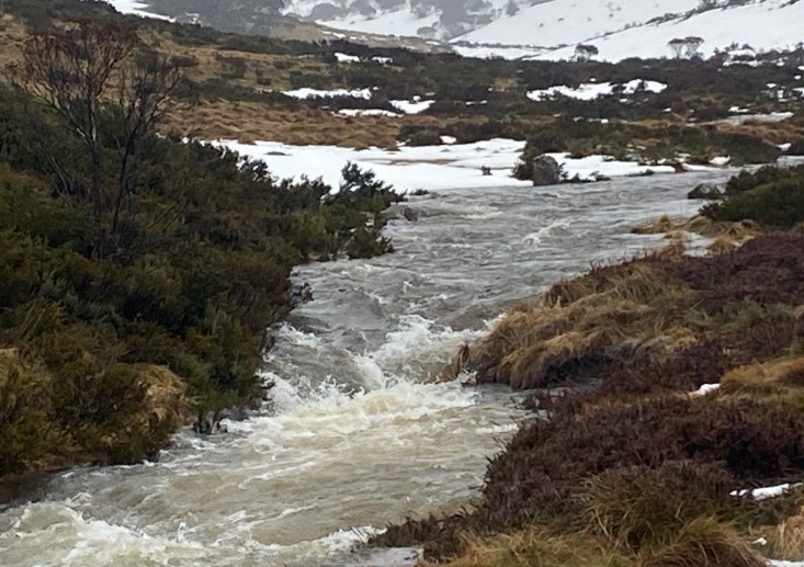
Image: Meanwhile a little lower down, creek banks are now almost snow-free. Source: Steve Smith.
This rain is obviously bad news, but there's good news for snow enthusiasts on three fronts:
Firstly, it seems highly likely that snow will fall from Friday into the weekend, repairing some (but likely not all) of the rain damage at Perisher and nearby resorts.
Secondly, the snowpack was in reasonable shape before this downpour, with over a metre at Spencers Creek, close to Perisher, Thredbo and Charlotte Pass, so while there will definitely be a few holes here and there around creeks, the overall cover on most runs should be OK by Monday.
Thirdly, this rain has been much heavier in NSW than the Victorian skifields, especially the southernmost two – Mt Buller and Mt Baw Baw. So if you're a Victorian skier or snowboarder, you've half-dodged a bullet.
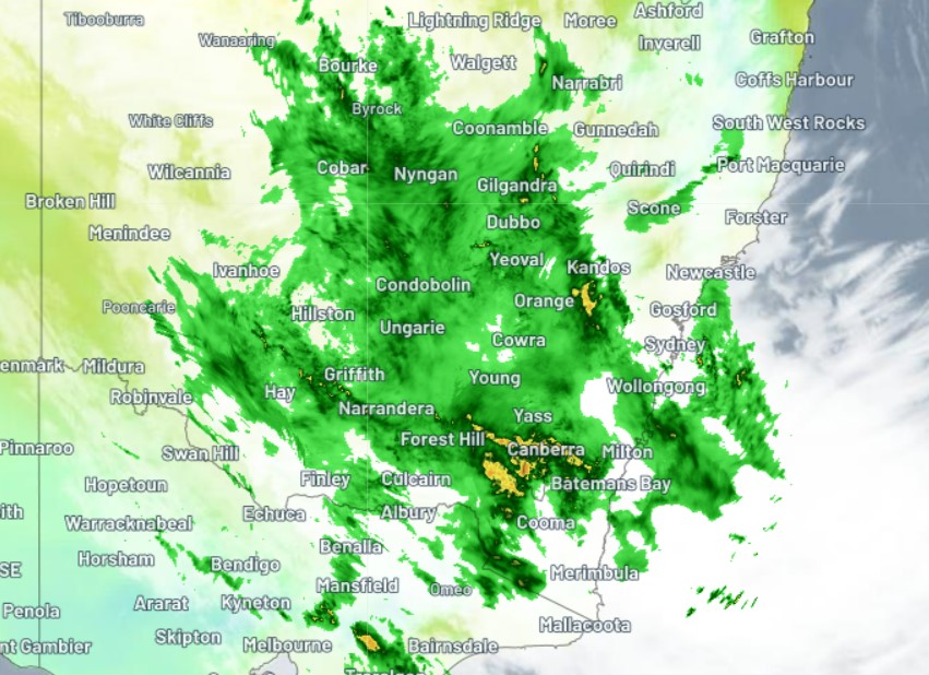
As you can see from the radar image above captured around 9 am Thursday, the main rainband was much heavier in NSW and border districts than southern Victoria, and the pattern has remained similar throughout the day.
To illustrate this with stats, here are some rainfall figures comparing NSW and Victorian ski resorts:
NSW
- Thredbo: 63.8 mm to 9 am Thurs, 47.6 mm 9 am to 4 pm Thurs
- Perisher: 64 mm to 9 am Thurs, 53.8 mm 9 am to 4 pm Thurs
VIC
- Falls Creek: 54.8 mm to 9 am, 19.8 mm 9 am to 4 pm Thurs
- Mt Buller: 3.6 mm to 9 am, 2.2 mm 9 am to 4 pm Thurs
Let's proceed to our weekly wrap of ski conditions:
Should I go to the snow this weekend?
It's not often we'd answer that question with a "yes" after so much rain, but as mentioned, snow is coming.
The Weatherzone gurus are predicting around 30 cm to fall in the mountains between Friday morning and Sunday morning and as ever, it will pay to check our snow page for the latest forecasts, cam images and more.
VICTORIA
Mt Hotham, Falls Creek and Mt Buller should all still have most of their lifts open, so check the highlighted links for more info.
Australia's lowest mainland resort, Mt Baw Baw, didn't get too much rain on Thursday, although warm temps took their toll after snow earlier this week. Four of its seven lifts are open. More info here.
NSW
Thredbo and Charlotte Pass could still have most lifts spinning despite the rain, so check the highlighted links for updates.
Tasmania
Still not such great news at Mt Mawson and Ben Lomond, where the patchy snow cover is suitable only for snow play, however snow should fall this weekend, so things may change by next week.